

Ohio map
Summit County map
About 538,370 people live here (Census Bureau, 2024 estimate). The sheet's index lists 7 streets; Akron Expressway, Ohio Turnpike and State Route 21 cross the most grid squares. Things to do inside the boundary: Akron Zoo, Akron/Summit County and Cuyahoga Falls.
Open the map (PDF, US Letter)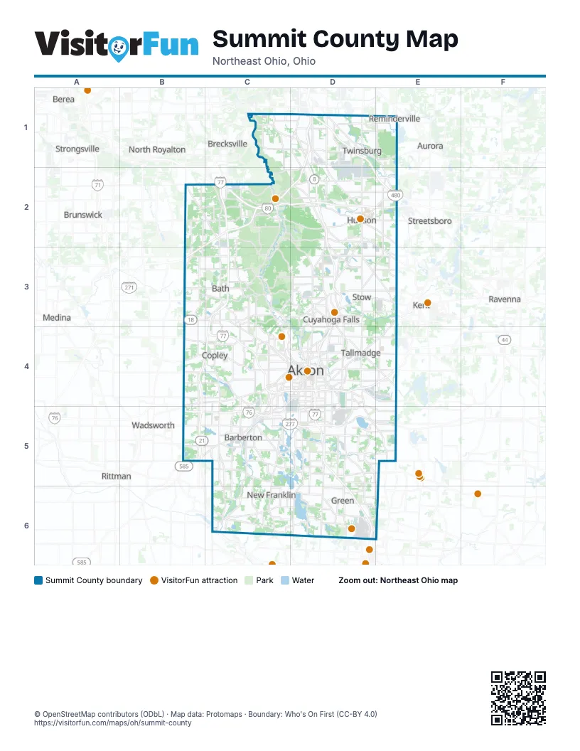
Street index of Summit County
Each street on the sheet and the grid squares it crosses.
- Akron ExpresswayD1, D2, D3, D4
- Outerbelt East FreewayD1
- Ohio TurnpikeC2, D2, E2
- State Route 21C3, B4, C4
- InnerbeltC4, D4
- Kenmore ExpresswayC4, C5
- East Waterloo RoadD5
Things to do on the Summit County map
Places on the map
- Abram's Farm
- Airport Park
- Akron
- Akron Children's Hospital
- Akron-Canton Corporate Park
- Arhaus HQ
- Ascot Industrial Park
- Ashbrooke
- Ashbrooke West
- Baker's Acres Estates
- Barberton Reservoir
- Bath Nature Preserve
- Bath Township
- Bell Industrial Park
- Boston Heights
- Boston Mills Ski Resort
- Boston Township
- Bradford Oaks
- Brandywine Ski Resort
- Briarwood Estates
- Bridgewater Place
- Brookledge Golf Course
- Brookside Greens
- BWXT NOG Barberton
- Call's Farm
- Canterbury on the Lakes
- Cascade Valley Metro Park
- Center Valley Park
- Chadd's Ford
- Chamberlin Ledges
- Chenoweth
- Chenoweth Estates
- Clinton
- Columbia Lake
- Comet Lake
- Connecticut Colony
- Connecticut Woods
- Copley Township
- Corner Stone Business Park
- Coventry Crossing
Next to Summit County
- Aurora
- Berea
- Brecksville
- Broadview Heights
- Brunswick
- Kent
- Medina
- Middleburg Heights
- North Royalton
- Ravenna
- Rittman
- Streetsboro
- Strongsville
- Wadsworth
© OpenStreetMap contributors (ODbL) · Map data: Protomaps · Boundary: Who's On First (CC-BY 4.0)