

Oregon map
Willamette Valley map
The sheet's index lists 17 highways; I-5, OR 22 and OR 126 cross the most grid squares. Things to do inside the boundary: Albany Historic Carousel and Museum, C&M Stables and Cascades Raptor Center. Also on it: Albany, Corvallis and Cottage Grove.
Open the map (PDF, US Letter)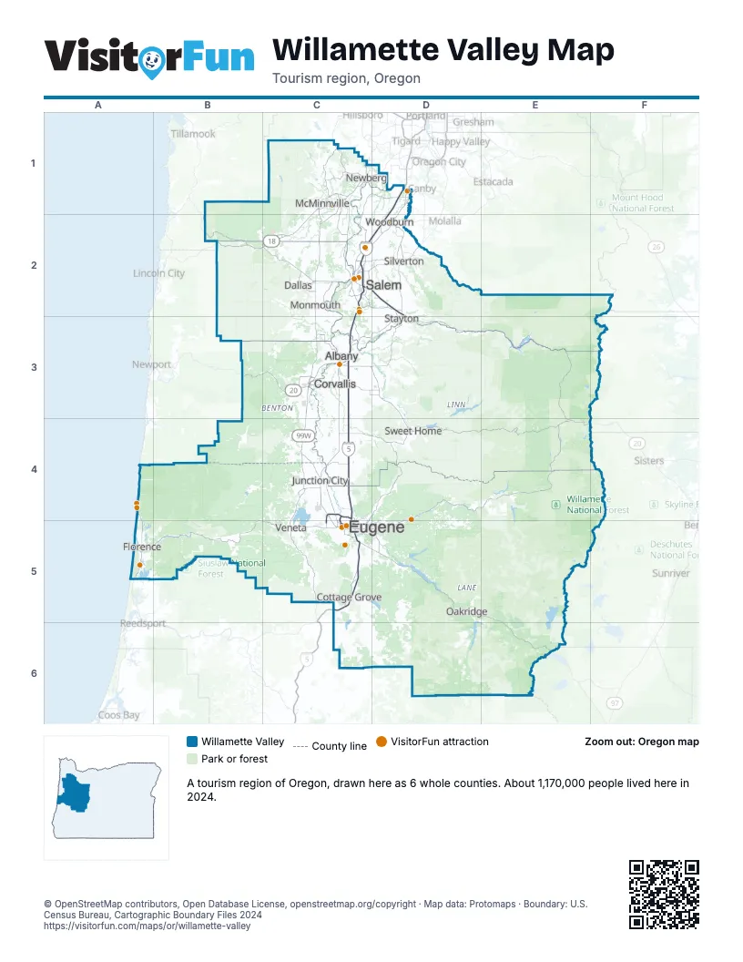
Highway index of Willamette Valley
Each highway on the sheet and the grid squares it crosses.
- I-5C2, C3, C4, C5, D1, D2
- I-105C5
- US 20B3, C3, E4
- US 101A4, A5
- OR 18B2, C1, C2
- OR 22B2, C2, D2, D3, E3, E4
- OR 34C3
- OR 47C1
- OR 58C5, D5, E5, E6
- OR 99C4, C5
- OR 99EC2, C3, D1
- OR 99WC1, C2, C3, C4, D1
- OR 126A5, B5, C5, D4, D5, E4
- OR 132C4, C5
- OR 219C1, D1
- OR 233C1
- OR 569C4, C5
Things to do on the Willamette Valley map
- Albany Historic Carousel and Museum
- C&M Stables
- Cascades Raptor Center
- Enchanted Forest
- Englewood Forest Festival
- Eugene Saturday Market
- Eugene Science Center
- Gallery Calapooia
- Heceta Head Lighthouse
- McKenzie River Lavender
- North American Aerospace Museum
- Oregon State Capitol
- Portland Rose Balloons
- Powerland Heritage Park
- Sand Dunes Frontier
- Sandland Adventures
- Sea Lion Caves
- Southern Oregon Coast
- Spirit Mountain Casino
- Travel Salem Visitor Center
- Vista Balloon Adventures
- Willamette Valley Vineyards
Places on the map
- Albany
- Corvallis
- Cottage Grove
- Dallas
- Eugene
- Florence
- Junction City
- McMinnville
- Monmouth
- Newberg
- Oakridge
- Salem
- Silverton
- Stayton
- Sweet Home
- Veneta
- Woodburn
Next to Willamette Valley
- Central Oregon map
- Mt. Hood & Columbia River Gorge map
- Oregon Coast
- Portland Region map
- Southern Oregon
© OpenStreetMap contributors, Open Database License, openstreetmap.org/copyright · Map data: Protomaps · Boundary: U.S. Census Bureau, Cartographic Boundary Files 2024