

Pennsylvania map
Laurel Highlands map
The sheet's index lists 17 highways; I-70, I-76 and US 119 cross the most grid squares. Things to do inside the boundary: Fallingwater, Flight 93 National Memorial and Frank Lloyd Wright's House on Kentuck Knob. Also on it: Brownsville, Connellsville and Derry.
Open the map (PDF, US Letter)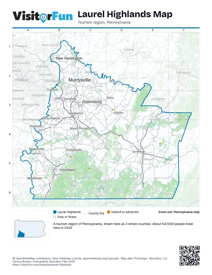
Highway index of Laurel Highlands
Each highway on the sheet and the grid squares it crosses.
- I-70A4, B3, B4, C3, C4, D4, D5, E5, F5
- I-76B2, B3, C3, C4, D4, D5, E5, F5
- US 22B2, C2, D2
- US 30B3, C3, D3, D4, E4, F4
- US 40A5, B5, B6, C6, D6
- US 119B3, B4, B5, C2, C3, C4, D2
- US 219E3, E4, E5, E6
- PA 21A5, B5
- PA 43B5, B6
- PA 51A3, A4, B4, B5
- PA 56C1, E2
- PA 66B1, B2, C1, C2, C3
- PA 166A5
- PA 281C6
- PA 711B4, B5, C4, E2
- PA 819C3
- SR 3091B3
Things to do on the Laurel Highlands map
Places on the map
- Brownsville
- Connellsville
- Derry
- Greensburg
- Irwin
- Jeannette
- Ligonier
- Masontown
- Monessen
- Mount Pleasant
- Murrysville
- New Kensington
- Somerset
- Trafford
- Uniontown
- West Newton
- Youngwood
Next to Laurel Highlands
- Western Maryland
- Pittsburgh & Its Countryside map
- The Alleghenies map
- Mountaineer Country
© OpenStreetMap contributors, Open Database License, openstreetmap.org/copyright · Map data: Protomaps · Boundary: U.S. Census Bureau, Cartographic Boundary Files 2024