

Washington map
Peninsulas Washington map
The sheet's index lists 7 highways; US 101, SR 3 and SR 104 cross the most grid squares. Things to do inside the boundary: Bainbridge Organic Distillers, Downtown Bainbridge Island and Dungeness River Nature Center. Also on it: Aberdeen, Bainbridge Island and Bremerton.
Open the map (PDF, US Letter)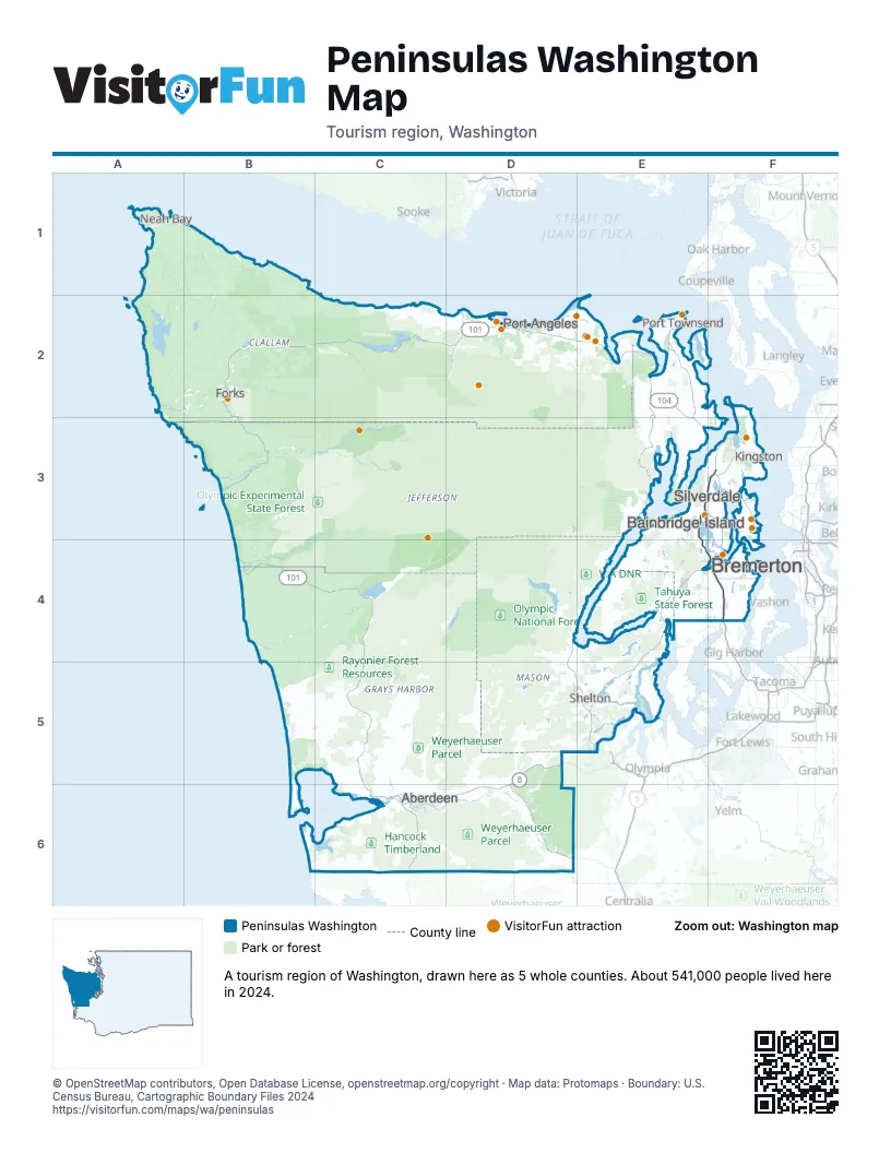
Highway index of Peninsulas Washington
Each highway on the sheet and the grid squares it crosses.
- US 12C6, D6
- US 101B2, B3, B4, C2, C4, C5, C6, D2, D4, D5, E2, E3, E4, E5
- SR 3E3, E4, F3, F4
- SR 8D5, D6
- SR 16E4, F4
- SR 104E2, E3, F3
- SR 304F4
Things to do on the Peninsulas Washington map
- Bainbridge Organic Distillers
- Downtown Bainbridge Island
- Dungeness River Nature Center
- Field Arts & Events Hall
- Forks Timber Museum
- Fort Worden
- Hoh Rain Forest
- Kitsap Mall
- Olympic Game Farm
- Olympic National Park
- Olympic Peninsula
- Port Angeles Fine Arts Center
- Puget Sound Express
- Puget Sound Navy Museum
- Sequim Lavender Trail
- Sequim Visitor Information Center
- The Madison Diner
- The Point Casino & Hotel
- US Naval Undersea Museum
Places on the map
- Aberdeen
- Bainbridge Island
- Bremerton
- Forks
- Kingston
- Neah Bay
- Port Angeles
- Port Townsend
- Shelton
- Silverdale
Next to Peninsulas Washington
© OpenStreetMap contributors, Open Database License, openstreetmap.org/copyright · Map data: Protomaps · Boundary: U.S. Census Bureau, Cartographic Boundary Files 2024