

California map
Marin County map
About 256,400 people live here (Census Bureau, 2024 estimate). The sheet's index lists 4 streets; Redwood Highway, John T. Knox Freeway and Richmond-San Rafael Bridge cross the most grid squares. Things to do inside the boundary: Angel Island State Park, Muir Woods National Monument and Point Reyes National Seashore.
Open the map (PDF, US Letter)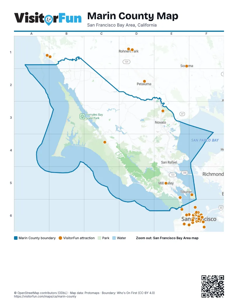
Street index of Marin County
Each street on the sheet and the grid squares it crosses.
- Redwood HighwayD2, E3, E4, E5, E6
- John T. Knox FreewayE4, E5
- Richmond-San Rafael BridgeE5, F5
- Golden Gate BridgeE6
Things to do on the Marin County map
Places on the map
- Abbotts Lagoon
- Alpine Lake
- Alta
- Angel Island State Park
- Arroyo Sausal Reservoir
- Ayala Cove
- Bahia Wetlands
- Bald Hill Open Space Preserve
- Batteries
- Bayside Acres
- Bel Marin Keys Lagoon
- Belvedere
- Belvedere Lagoon
- Black Point-Green Point
- Bodega Head State Marine Conservation Area
- Bolinas
- Bolinas Lagoon Preserve
- Bon Tempe Lake
- California Park
- Cascade Canyon Preserve
- China Camp State Park
- Corte Madera
- Corte Madera Creek
- Country Club
- Deer Island Basin
- Deer Island Preserve
- Dillon Beach
- Drakes Beach
- Estero Americano
- Estero de San Antonio
- Fairfax Open Space Preserve
- Gary Giacomini Open Space Preserve
- Golden Gate National Recreation Area
- Greater Farallones National Marine Sanctuary
- Greenbrae Boardwalk
- Hamilton Wetlands
- Harry A Barbier Memorial Park
- Herons Beak Pond
- Horse Hill Open Space Preserve
- Horseshoe Pond
Next to Marin County
- Petaluma
- Richmond
- Rohnert Park
- San Francisco map
- Sonoma
© OpenStreetMap contributors (ODbL) · Map data: Protomaps · Boundary: Who's On First (CC-BY 4.0)