

California map
San Mateo County map
About 742,893 people live here (Census Bureau, 2024 estimate). The sheet's index lists 11 streets; Bayshore Freeway, Junipero Serra Freeway and Cabrillo Highway cross the most grid squares. Things to do inside the boundary: Filoli and Half Moon Bay.
Open the map (PDF, US Letter)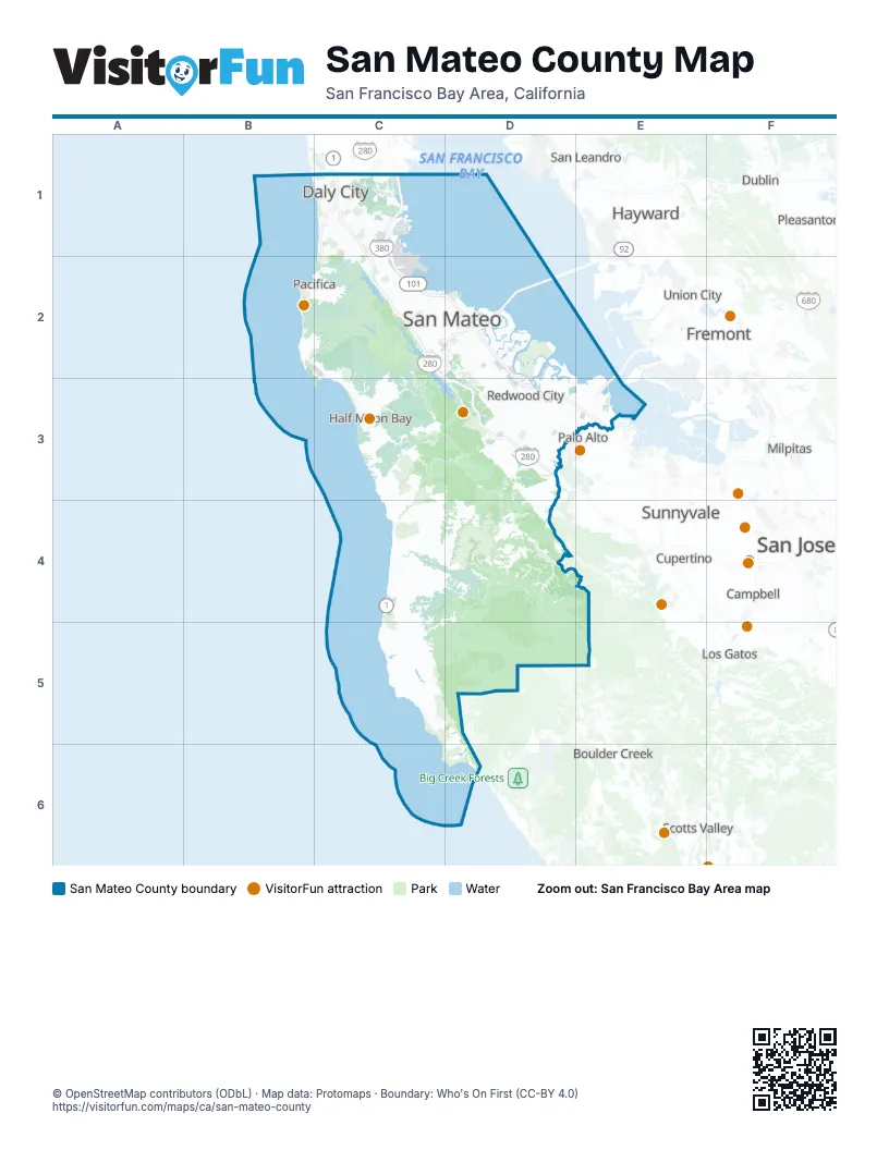
Street index of San Mateo County
Each street on the sheet and the grid squares it crosses.
- Bayshore FreewayC1, C2, D2, D3, E3
- Cabrillo HighwayC1, C2
- James Lick FreewayC1
- John F Foran FreewayC1
- Junipero Serra BoulevardC1
- Junipero Serra FreewayC1, C2, D3
- Quentin L. Kopp FreewayC1
- J Arthur Younger FreewayC2, D2
- San Mateo - Hayward BridgeD2
- Bayfront ExpresswayE3
- Dumbarton BridgeE3
Things to do on the San Mateo County map
Places on the map
- Año Nuevo State Marine Reserve
- Año Nuevo State Park
- Arroyo de los Frijoles
- Atherton
- Audubon Society
- Bair Island Ecological Reserve
- Bean Hollow State Beach
- Bedwell Bayfront Park
- Belle Haven
- Belmont
- Belmont Slough
- Big Canyon Park
- Brisbane
- Brisbane Lagoon
- Broadmoor
- Burleigh H. Murray Ranch State Park
- Burlingame
- Burlingame Country Club
- Burlingame Hills
- Burns Valley Road
- Butano Crest West
- Butano Farms
- Butano State Park
- Cascade Ranch
- Cloverdale Coastal Ranches
- Coal Creek Open Space Preserve
- Coal Mine Ridge Preserve
- Colma
- Cordilleras Creek
- Cow Palace
- Crocker Industrial Park
- Crocker Lake Open Space
- Crystal Springs Golf Course
- Daly City
- Diamond H Ranch
- East Palo Alto
- El Corte de Madera Creek Open Space Preserve
- El Granada
- Emerald Lake Hills
- Filoli Estate
Next to San Mateo County
- Boulder Creek
- Campbell
- Cupertino
- Dublin
- Fremont map
- Hayward
- Los Gatos
- Milpitas
- Mountain View
- Newark
- Palo Alto
- Pleasanton
- San Jose map
- San Leandro
- Santa Clara
- Saratoga
- Scotts Valley
- Sunnyvale
- Union City
© OpenStreetMap contributors (ODbL) · Map data: Protomaps · Boundary: Who's On First (CC-BY 4.0)