

Colorado map
Jefferson County map
About 578,533 people live here (Census Bureau, 2024 estimate). The sheet's index lists 6 streets; Golden Freeway, C-470 and Denver–Boulder Turnpike cross the most grid squares. Things to do inside the boundary: Buffalo Bill Museum and Grave, Casa Bonita and Coors Brewery Tour.
Open the map (PDF, US Letter)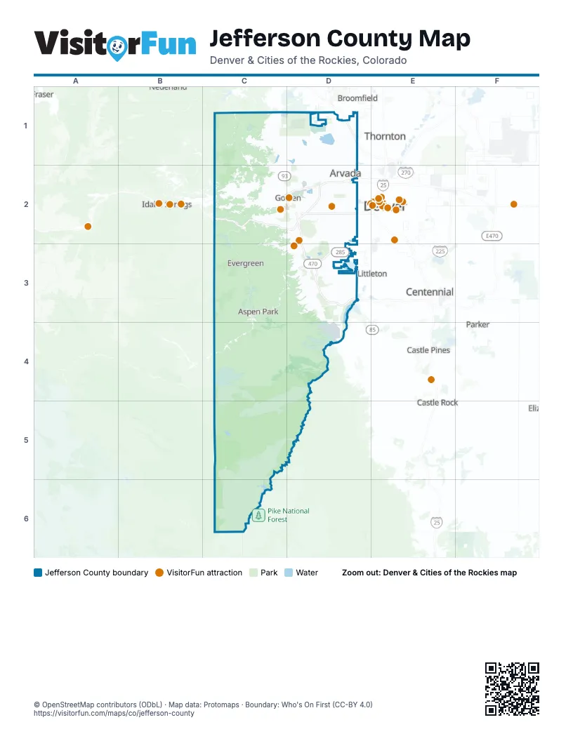
Street index of Jefferson County
Each street on the sheet and the grid squares it crosses.
- Denver–Boulder TurnpikeD1
- Golden FreewayC2, D2
- C-470D2, D3
- Heartland ExpresswayD2
- West 6th Avenue FreewayD2
- West Hampden Avenue FreewayD3
Things to do on the Jefferson County map
Places on the map
- Alderfer/Three Sisters Park
- Allendale
- Alta Vista
- Apex Park
- Applewood
- Area closed to public
- Arvada
- Aspen Park
- Avanti
- Bear Creek Estates
- Bear Creek Golf Club
- Bear Creek Lake
- Bear Creek Lake Park
- Bear Valley Open Space
- Beaver Ranch Disc Golf Course
- Beaver Ranch Park
- Belleview Farms
- Belmar Park
- Benton Park
- Big Dry Creek Open Space
- Big Soda Lake
- Black Bear Trail Easment
- Blunn Reservoir
- Bowles Reservoir #1
- Cameo Estates
- Canterbury
- CanyonView
- Cathedral Spires Park
- Centennial Cone Park
- Chatfield Reservoir
- Clarabelle on Grandview
- Clear Creek
- Clear Creek Canyon Park
- Clear Creek Canyon Park (MVCC)
- Coal Creek Canyon Study Area
- Colorado State Patrol Track
- Columbine
- Columbine Hills
- Columbine HIlls
- Columbine Knolls
Next to Jefferson County
- Broomfield
- Castle Pines
- Castle Rock
- Centennial
- Denver map
- Englewood
- Fraser
- Highlands Ranch
- Idaho Springs
- Littleton
- Parker
- Thornton
© OpenStreetMap contributors (ODbL) · Map data: Protomaps · Boundary: Who's On First (CC-BY 4.0)