

Massachusetts map
Bristol County map
About 588,593 people live here (Census Bureau, 2024 estimate). The sheet's index lists 5 streets; Amvets Highway, East Providence Expressway and Western Fall River Expressway cross the most grid squares. Things to do inside the boundary: Battleship Cove and Lizzie Borden House.
Open the map (PDF, US Letter)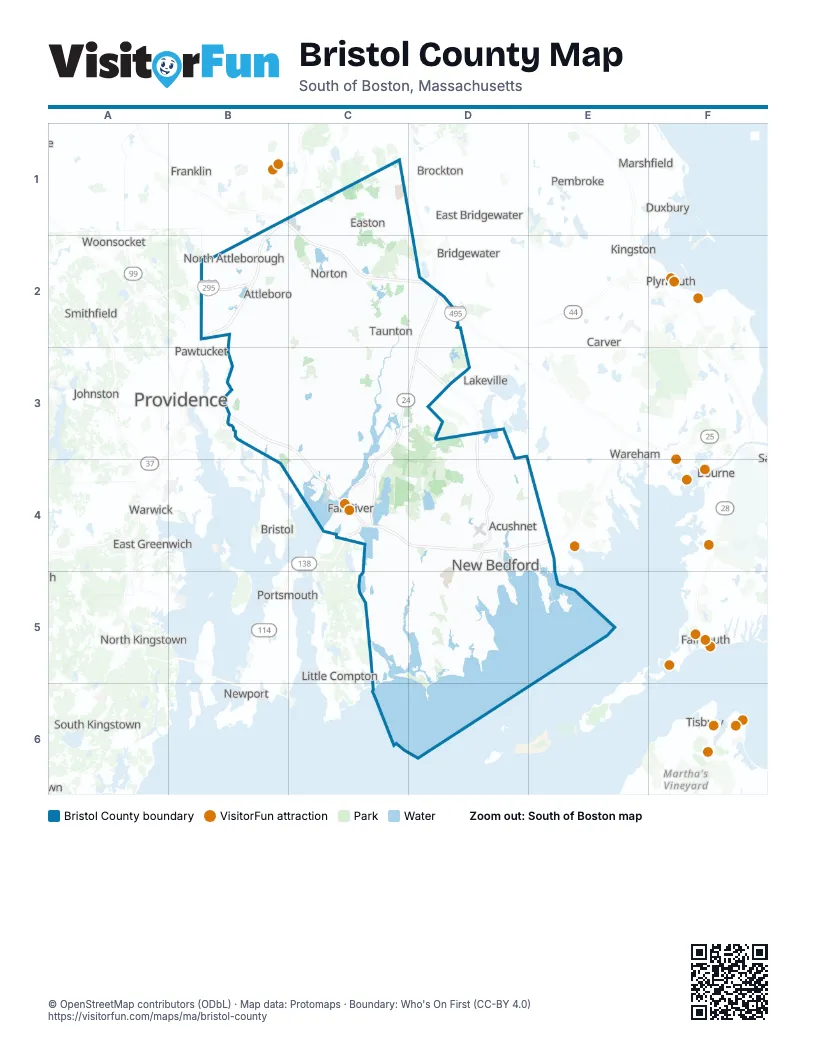
Street index of Bristol County
Each street on the sheet and the grid squares it crosses.
- Amvets HighwayD2, C3, D3, C4
- East Providence ExpresswayB3
- Western Fall River ExpresswayC4
- Alfred Bessette Memorial HighwayD4
- John F. Kennedy HighwayD4
Things to do on the Bristol County map
Places on the map
- Acushnet
- Acushnet Cedar Swamp State Res
- Acushnet Quarry
- Acushnet River Valley
- Allendale Country Club
- Allens Pond
- Allens Pond Marshes
- Allens Pond Wildlife Sanctuary
- Ames Rifle & Pistol Club
- Arthur Sharp Estate
- Attleboro
- Attleboro Corporate Center
- Attleboro Industrial Park
- Azevedo Farm
- Bay State Beagle Club
- Beagel Nest Farm
- Bear Swamp
- Beaver Brook Woods
- Berkley
- Bettencourt
- Big Ram Island
- Black Brook Conservation Area
- Black Brook Conservation Land
- Black Brook Management Area
- Boro Sand and Stone
- Boyden Park
- Branch street woods
- Brayton Point Power Station
- Bris Cnty Agr School
- Bris Cnty Agr. School
- Bristol County
- Broad Cove
- Bungay River Conservation Area
- Bushnee Rd Property
- Buttonwood Park
- Cabot Business Park
- Cabot Forbes Parcels
- Camp Myles Standish
- Camp Ramsbottom
- Canoe River Access
Next to Bristol County
- Abington
- Bourne
- Bridgewater
- Bristol
- Brockton
- Carver
- Duxbury
- East Bridgewater
- East Greenwich
- Exeter
- Falmouth
- Franklin
- Johnston
- Kingston
- Lakeville
- Little Compton
- Marshfield
- Mattapoisett
- Narragansett
- Newport
- North Kingstown
- Oak Bluffs
- Pawtucket
- Pembroke
- Plymouth
- Portsmouth
- Providence
- Smithfield
- South Kingstown
- Tisbury
- Tiverton
- Wareham
- Warwick
- West Warwick
- Woonsocket
© OpenStreetMap contributors (ODbL) · Map data: Protomaps · Boundary: Who's On First (CC-BY 4.0)