

Massachusetts map
South of Boston map
The sheet's index lists 17 highways; I-195, US 44 and I-495 cross the most grid squares. Things to do inside the boundary: Battleship Cove, Buzzards Bay Yacht Charters and Captain John Boats. Also on it: Attleboro, Bridgewater and Brockton.
Open the map (PDF, US Letter)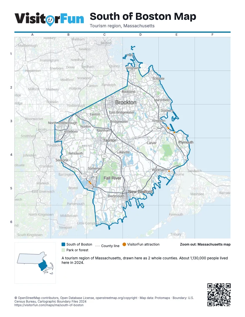
Highway index of South of Boston
Each highway on the sheet and the grid squares it crosses.
- I-95B3, B4
- I-195B4, B5, C5, D4, D5
- I-295B3
- I-495B3, C3, C4, D4
- US 6C5, D5
- US 44B4, C4, D3, D4, E3
- MA 3D2, D3, E3, E4
- MA 18D5
- MA 24C2, C3, C4, C5
- MA 25D4, E4
- MA 58D3
- MA 79C4, C5
- MA 106C3
- MA 123B3, C3
- MA 138C3, C4, C5
- MA 140B3, C4, C5, D5
- MA 240D5
Things to do on the South of Boston map
Places on the map
- Attleboro
- Bridgewater
- Brockton
- Carver
- Dartmouth
- Duxbury
- East Bridgewater
- Easton
- Fall River
- Hingham
- Hull
- Kingston
- Lakeville
- Marshfield
- New Bedford
- North Attleborough
- Norton
- Plymouth
- Raynham
- Rehoboth
- Rockland
- Scituate
- Seekonk
- Somerset
- Taunton
- Wareham
Next to South of Boston
- Cape Cod & The Islands
- Greater Boston map
- Blackstone Valley
- Newport and Bristol Counties
© OpenStreetMap contributors, Open Database License, openstreetmap.org/copyright · Map data: Protomaps · Boundary: U.S. Census Bureau, Cartographic Boundary Files 2024