

Minnesota map
Southern Minnesota map
The sheet's index lists 14 highways; I-90, US 14 and MN 60 cross the most grid squares. Things to do inside the boundary: Apache Mall, Beaver Creek Valley State Park and Blue Mounds State Park. Also on it: Albert Lea, Austin and Benson.
Open the map (PDF, US Letter)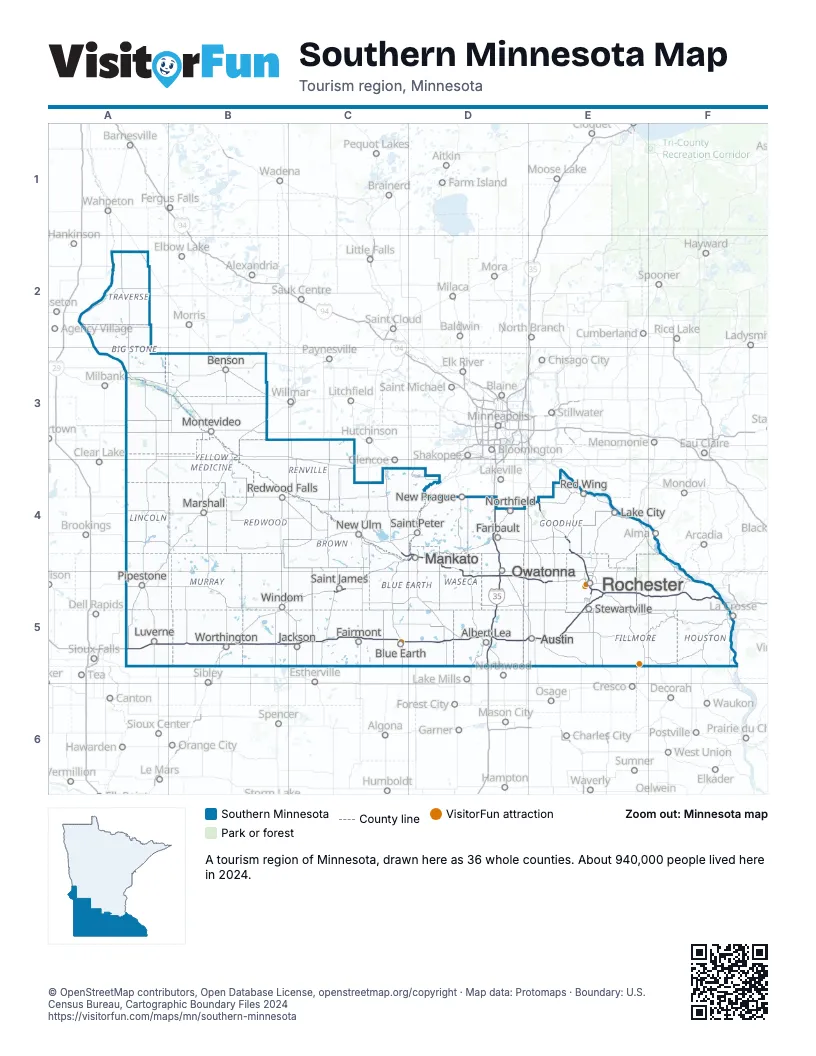
Highway index of Southern Minnesota
Each highway on the sheet and the grid squares it crosses.
- I-35D4, D5
- I-90A5, B5, C5, D5, E5, F5
- US 14C4, D4, D5, E5, F5
- US 52E4, E5
- US 61F5
- US 63E4, E5
- US 169D4
- US 218D5, E5
- MN 4C5
- MN 15C5
- MN 30C5
- MN 43F5
- MN 56E5
- MN 60C5, D4, E4
Things to do on the Southern Minnesota map
- Apache Mall
- Beaver Creek Valley State Park
- Blue Mounds State Park
- Flandrau State Park
- Forestville/Mystery Cave State Park
- Frontenac State Park
- Great River Bluffs State Park
- Historic Mayowood
- History Center of Olmsted County
- Jolly Green Giant Statue
- Lake Shetek State Park
- Minnesota Marine Art Museum
- Minnesota State Public School for Dependent and Neglected Children
- Niagara Cave
- Pipestone National Monument
- Polish Cultural Center & Museum
- Renville County Historical Museum
- Rice Lake State Park
- Soldiers Field Veterans Memorial
- SPAM Museum
- Wanda Gág House
Places on the map
- Albert Lea
- Austin
- Benson
- Blue Earth
- Fairmont
- Faribault
- Jackson
- Lake City
- Luverne
- Mankato
- Marshall
- Montevideo
- New Prague
- New Ulm
- Northfield
- Owatonna
- Pipestone
- Red Wing
- Redwood Falls
- Rochester
- Saint James
- Saint Peter
- Stewartville
- Windom
- Worthington
Next to Southern Minnesota
- Driftless Area
- Lakes and Land
- Central Minnesota map
- Minneapolis-St. Paul map
- Northwest Minnesota map
- Southeast North Dakota
- Glacial Lakes & Prairies
- Southeast South Dakota
- Northwest Wisconsin
- Southwest Wisconsin
© OpenStreetMap contributors, Open Database License, openstreetmap.org/copyright · Map data: Protomaps · Boundary: U.S. Census Bureau, Cartographic Boundary Files 2024