

New Jersey map
Monmouth County map
About 647,520 people live here (Census Bureau, 2024 estimate). The sheet's index lists 4 streets; Garden State Parkway, Central Jersey Expressway and Freehold Bypass cross the most grid squares. Things to do inside the boundary: Circle A Stables, Sandy Hook and The Stone Pony.
Open the map (PDF, US Letter)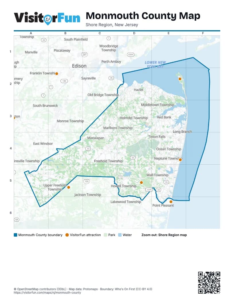
Street index of Monmouth County
Each street on the sheet and the grid squares it crosses.
- Garden State ParkwayD2, D3, E3, E4, D5, E5
- Freehold BypassC4, D4
- Garden State Parkway (Express Lanes) SouthboundE4
- Central Jersey ExpresswayA5, B5, C5, D5, E5
Things to do on the Monmouth County map
Places on the map
- Aberdeen Township
- Allaire Country Club Estates
- Allaire State Park
- Allenhurst
- Allentown
- Allenwood
- Anne Ellen Christmas Tree Farm
- Ardmore Estates
- Asbury Park
- Assunpink Lake
- Assunpink Wildlife Management Area
- Atlantic Highlands
- Avon-by-the-Sea
- Battleground Country Club
- Battleview Orchards
- Bayonet Farms
- Bayshore Waterfront Park
- Belford
- Belmar
- Big Brook Park
- Bradley Beach
- Brick Reservoir
- Brielle
- Buttonwood Acres
- Capelli Sport Complex
- Cedar Village at Ocean
- CentraState Medical Center
- Cliffwood Beach
- Colts Neck Golf Club
- Colts Neck Township
- Community Park
- Country Estates
- Cream Ridge
- Cream Ridge Golf Course
- Daydream Farm
- Deal
- Deal Lake
- Durand Park
- East Freehold
- Eatontown
Next to Monmouth County
- Brick Township
- Carteret
- Cranbury
- East Brunswick
- East Windsor
- Edison
- Franklin Township
- Jackson Township
- Lakewood Township
- Manville
- Metuchen
- Monroe Township
- New Brunswick
- North Brunswick
- Old Bridge Township
- Perth Amboy
- Piscataway
- Point Pleasant
- Robbinsville Township
- Sayreville
- Somerville
- South Brunswick
- South Plainfield
- West Windsor
- Woodbridge Township
© OpenStreetMap contributors (ODbL) · Map data: Protomaps · Boundary: Who's On First (CC-BY 4.0)