

New York map
Oneida County map
About 228,347 people live here (Census Bureau, 2024 estimate). The sheet's index lists 8 streets; New York State Thruway, North-South Arterial Highway and State Highway 8 cross the most grid squares. Also on it: Albert J. Woodford Memorial State Forest, Atunyote at Turning Stone and Barneveld.
Open the map (PDF, US Letter)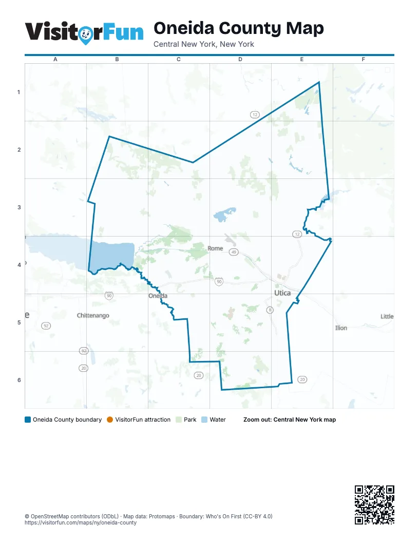
Maps inside Oneida County
1 map inside, from the street map of Oneida County down.
Street index of Oneida County
Each street on the sheet and the grid squares it crosses.
- New York State ThruwayC4, D4, E4
- Horatio StreetE4
- North-South Arterial HighwayE4, D5, E5
- State Highway 8E4, D5
- State HIghway 8E4
- State Route 49E4
- Capron RoadD5
- Judd Road ExpresswayD5
Places on the map
- Albert J. Woodford Memorial State Forest
- Atunyote at Turning Stone
- Barneveld
- Big Brook State Forest
- Black River Fishing Access
- Bridgewater
- Buck Hill State Forest
- Buck Lake
- Canada Creek State Forest
- Chadwicks
- Chittning Pond
- Chobani Plant
- City of Rome
- City of Sherrill
- City of Utica
- Clark Hill State Forest
- Clark Mills
- Cobb Brook State Forest
- Crestwood Golf Club
- Delta Lake State Park
- Delta Reservoir
- Domenico's Golf Course
- Durhamville
- Echo Lake
- Fall Brook State Forest
- Feeder Forest
- Fish Creek State Forest
- Florence Hill State Forest
- Forestport Reservoir
- Furnace Creek State Forest
- Gorton Lake State Forest
- Hamilton College
- Havener farm
- Hidden Valley Golf Club
- Hogsback State Forest
- Jackson Hill State Forest
- Kaluhyat Golf Course
- Kayuta Lake
- Lake Delta
- Long Lake
Next to Oneida County
- Canastota
- Chittenango
- DeWitt
- Ilion
- Little Falls
- Oneida
© OpenStreetMap contributors (ODbL) · Map data: Protomaps · Boundary: Who's On First (CC-BY 4.0)