

Pennsylvania map
Bucks County map
About 650,131 people live here (Census Bureau, 2024 estimate). The sheet's index lists 17 streets; Delaware Expressway, Pennsylvania Turnpike and Pennsylvania Turnpike Northeast Extension cross the most grid squares. Also on it: 5 Mile Woods, Ann's Choice and Arbor Point.
Open the map (PDF, US Letter)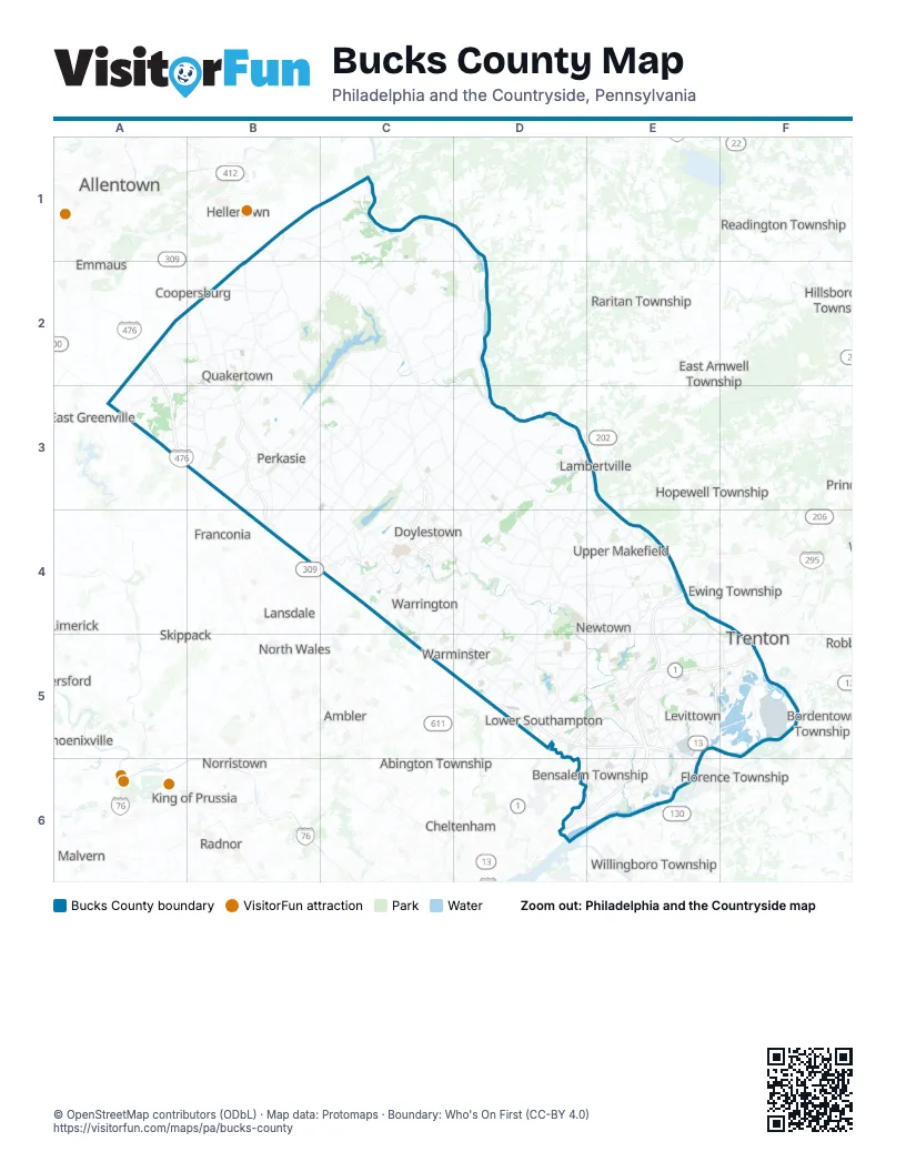
Street index of Bucks County
Each street on the sheet and the grid squares it crosses.
- Pennsylvania Turnpike Northeast ExtensionA2, A3
- Sellersville BypassB3, B4
- Easton RoadC3, C4
- North Easton RoadC3
- New Hope BridgeD3
- New Hope-Lambertville Toll BridgeD3
- Doylestown BypassC4
- US 202 ParkwayC4
- Delaware ExpresswayE4, E5, D6, E6
- Scudder Falls BridgeE4
- Lincoln HighwayD5, E5
- Pennsylvania TurnpikeD5, E5, E6
- Bristol PikeE5, F5
- Martin Luther King Jr. ExpresswayE5, F5
- Pine Grove RoadF5
- Trenton-Morrisville Toll BridgeF5
- Woodhaven RoadD6
Places on the map
- 5 Mile Woods
- Ann's Choice
- Arbor Point
- Bedminster Township
- Bensalem Township
- Bluestone Creek
- Bowman's Tower Farm
- Bridge Valley at Furlong
- Bridgeton Township
- Bridle Estates
- Bristol
- Bristol Township
- Brittany Farms
- Buckingham Forest
- Buckingham Township
- Buckland Valley Farms
- Bucks County
- Central Park
- Chalfont
- Churchville
- Churchville Park
- Cider Knoll
- Coleman Farms
- Come Along Farm
- Core Creek Park
- Cornwells Heights-Eddington
- Country Bend
- Creeks Bend
- Croydon
- Dark Hollow
- Deerbrook Creek Park
- Devonshire Estates
- Dolington Estates
- Doylestown
- Doylestown Airport
- Doylestown Country Club
- Doylestown Township
- Dublin
- Dunkin Donuts
- Durham Township
Next to Bucks County
- Abington Township
- Allentown
- Ambler
- Bethlehem
- Bordentown Township
- Cheltenham
- Conshohocken
- Coopersburg
- Delran Township
- East Amwell Township
- East Greenville
- Emmaus
- Ewing Township
- Flemington
- Florence Township
- Franconia
- Glenside
- Hamilton Township
- Hellertown
- Hillsborough Township
- Hopewell Township
- Horsham
- King of Prussia
- Lambertville
- Lansdale
- Lawrence Township
- Limerick
- Malvern
- Norristown
- North Wales
- Phoenixville
- Radnor
- Raritan Township
- Readington Township
- Royersford
- Skippack
- Trappe
- Trenton
- West Amwell Township
- Westampton
- Whitemarsh
- Willingboro Township
© OpenStreetMap contributors (ODbL) · Map data: Protomaps · Boundary: Who's On First (CC-BY 4.0)