

Utah map
Canyon Country map
The sheet's index lists 4 highways; I-70, US 6 and US 50 cross the most grid squares. Things to do inside the boundary: Adrift Adventures, Adventure ORX and Arches National Park. Also on it: Blanding, Kanab and Loa.
Open the map (PDF, US Letter)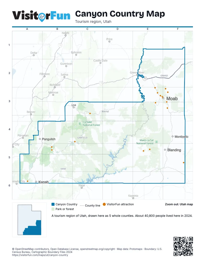
Highway index of Canyon Country
Each highway on the sheet and the grid squares it crosses.
- I-70E2, F2
- US 6E2, F2
- US 50E2, F2
- US 191E2
Things to do on the Canyon Country map
- Adrift Adventures
- Adventure ORX
- Arches National Park
- Bears Ears National Monument
- Best Western Plus Ruby's Inn
- Blu Pig
- Bryce Canyon National Park
- Canyonlands Ballooning
- Canyonlands by Night and Day
- Canyonlands Jeep Adventures
- Capitol Reef National Park
- Chile Pepper Bike Shop
- Coral Pink Sand Dunes State Park
- Coyote Land Tours
- Dan Mick's Guided Jeep Tours
- Dead Horse Point State Park
- Delicate Arch
- Desert Highlights
- Desert Sun Ceramics
- E-Bike Moab
- Gearheads Outdoor Store
- Grand Staircase-Escalante National Monument
- High Point Hummer & ATV
- Hole N" The Rock
- Hovenweep National Monument
- Moab Adventure Center
- Moab Giants
- Moab Jett
- Moab Rock Shop
- Moab Tour Company
- Moab Tourism Center
- Natural Bridges National Monument
- Paddle Moab
- Raven's Rim Adventure Tours
- Redtail Air Adventures
- Rope Swing Moab
- Sheri Griffith River Expeditions
- Skydive Moab
- Spanish Valley Vineyard & Winery
- Stargazing Moab
- Wild West Voyages
Places on the map
- Blanding
- Kanab
- Loa
- Moab
- Monticello
- Panguitch
Next to Canyon Country
- Northern Arizona
- West Coast Arizona
- Mountains & Mesas
- The Great West
- Northwest New Mexico
- Central Utah map
- Dixie map
- Eastern Utah map
© OpenStreetMap contributors, Open Database License, openstreetmap.org/copyright · Map data: Protomaps · Boundary: U.S. Census Bureau, Cartographic Boundary Files 2024