

Washington map
Kitsap County map
About 281,420 people live here (Census Bureau, 2024 estimate). The sheet's index lists 5 streets; State Highway 3 Northwest, State Highway 16 and Charleston Boulevard cross the most grid squares. Things to do inside the boundary: Bainbridge Organic Distillers, Downtown Bainbridge Island and Greater Kingston Community Chamber of Commerce Visitor Center.
Open the map (PDF, US Letter)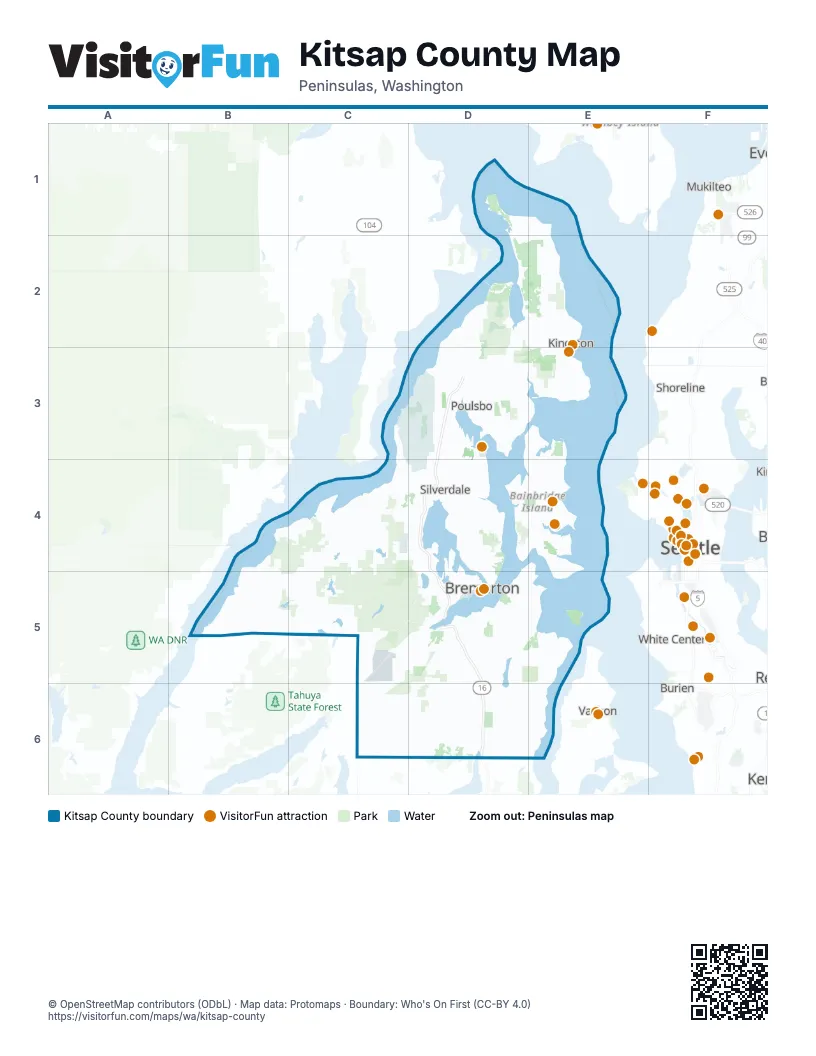
Street index of Kitsap County
Each street on the sheet and the grid squares it crosses.
- State Highway 3 NorthwestD3, D4, D5
- Charleston BoulevardD5
- State Highway 16D5, D6
- State Highway 16 SouthwestD5
- State Highway 3 WestD5
Things to do on the Kitsap County map
Places on the map
- Agate Passage
- Alpine U Cut Christmas Trees
- Anderson Landing Preserve
- Appletree Cove
- Bainbridge Island
- Banner Forest Heritage Park
- Barker Creek Corridor
- Bethel
- Big Beef Creek Wildlife Area
- Big Beef Harbor
- Blake Island
- Blakely Harbor
- Blakely Harbor Park
- Bremerton
- Bremerton Raceway
- Bremerton Watershed
- Buck Lake County Park
- Burke Bay
- Burley
- Calvinwood Park
- Camp Wesley Harris
- Central Kitsap Fire District
- Chico
- Chico Bay
- Clam Bay
- Coon Bay
- Coulter Creek Heritage Park
- Curley Creek Tyner Preserve
- Deer Park Loop Trail
- Dickey Pit
- Driftwood Cove
- Dyes Inlet
- Eagle Harbor
- East Housing
- East Port Orchard
- Eglon Forest
- Enetai
- Erlands Point
- Fort Ward Historic District
- Foulweather Bluff Beach
Next to Kitsap County
- Burien
- Kent
- Mukilteo
- Seattle map
- Shoreline
- Vashon
- White Center
© OpenStreetMap contributors (ODbL) · Map data: Protomaps · Boundary: Who's On First (CC-BY 4.0)