

California map
Monterey County map
About 436,251 people live here (Census Bureau, 2024 estimate). Things to do inside the boundary: 17-Mile Drive, Big Sur Lodge and Bixby Bridge. Also on it: Andrew Molera State Park, Big Creek State Marine Reserve and Brazil Ranch.
Open the map (PDF, US Letter)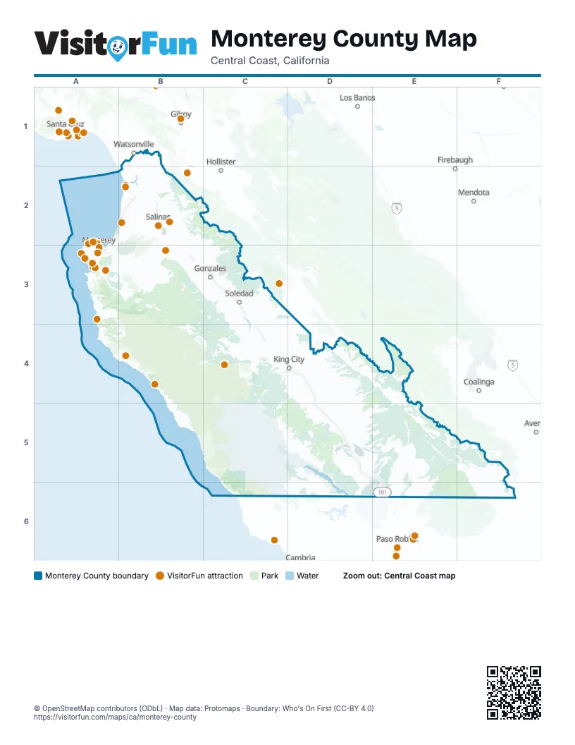
Things to do on the Monterey County map
- 17-Mile Drive
- Big Sur Lodge
- Bixby Bridge
- Bruno's Market & Deli
- Cafe Fina
- Cannery Row
- Cannery Row Antique Mall
- Carmel Mission Basilica
- Carmel Plaza
- Carmel-by-the-Sea
- Central Coast Scuba
- Chris' Fishing and Whale Watching
- Del Monte Center
- Discovery Whale Watch
- Fish Hopper
- Fishwife
- Julia Pfeiffer Burns State Park
- Links Club
- Little Mermaid Glass Bottom Boat Tours
- Monterey Bay Aquarium
- Monterey Bay Eco Tours
- Monterey Bay Equestrian Center
- Monterey Bay Whale Watch
- Monterey Mirror Maze
- Monterey Touring Vehicles
- Monterey Zoo
- Old Fisherman's Grotto
- Old Fisherman's Wharf
- Pacific Grove
- Pacific Grove Museum of Natural History
- Pebble Beach Golf Links
- Princess Monterey Whale Watching
- Refuge
- Salinas City Center
- Sanctuary Cruises
- Sea Goddess Whale Watching
- The Crossroads Carmel
- The Hotel Carmel
Places on the map
- Andrew Molera State Park
- Big Creek State Marine Reserve
- Brazil Ranch
- Fort Ord Cleanup Restricted Area
- Fort Ord Dunes State Park
- Fort Ord National Monument
- Garland Ranch Regional Park
- Garrapata State Park
- Ishxenta State Park
- Joshua Creek Canyon Ecological Reserve
- Marina Municipal Airport
- Mesa Del Rey Airport
- Palo Corona Regional Park
- Pfeiffer Big Sur State Park
- Point Sur State Marine Conservation Area
- Point Sur State Marine Reserve
- Rana Creek Ranch Preserve
- Rocks Ranch Reserve
- San Antonio Reservoir Recreation Area
- Silver Peak Wilderness
- Toro County Park
- U.S. Army Garrison Fort Hunter Liggett
- Ventana Wilderness
Next to Monterey County
- Avenal
- Coalinga
- Firebaugh
- Gilroy
- Hollister
- Los Banos
- Mendota
- Paso Robles
- Santa Cruz
- Watsonville
© OpenStreetMap contributors (ODbL) · Map data: Protomaps · Boundary: Who's On First (CC-BY 4.0)