

Massachusetts map
Cape Cod & The Islands map
The sheet's index lists 4 highways; US 6, MA 28 and MA 3 cross the most grid squares. Things to do inside the boundary: 3 Dukes Fishing, Aquinnah Cliffs and Arnold's Lobster & Clam Bar. Also on it: Barnstable, Bourne and Brewster.
Open the map (PDF, US Letter)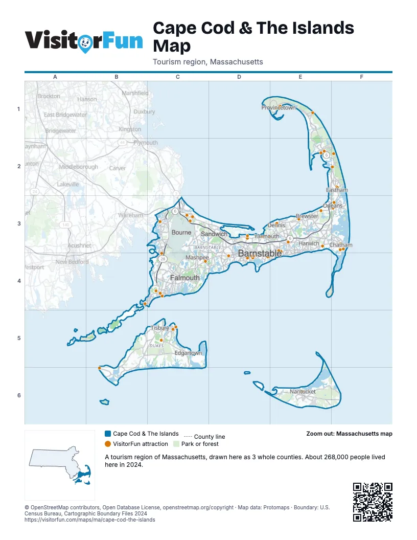
Highway index of Cape Cod & The Islands
Each highway on the sheet and the grid squares it crosses.
- US 6C3, D3, E1, E2, E3, F2, F3
- MA 3C3
- MA 25C3
- MA 28C3, C4
Things to do on the Cape Cod & The Islands map
- 3 Dukes Fishing
- Aquinnah Cliffs
- Arnold's Lobster & Clam Bar
- Bass River Kayaks and Paddle Boards
- Black Dog Tall Ships
- Bookstore & Restaurant
- Cahoon Museum of American Art
- Cape Cod
- Cape Cod Canal Region
- Cape Cod Central Railroad
- Cape Cod Lobster Cruises
- Cape Cod Melody Tent
- Cape Cod Museum of Art
- Cape Cod Museum of Natural History
- Cape Cod National Seashore
- Cape Cod Rail Trail
- Cape Escape Adventure Golf
- Cataumet Crossing
- Center for Coastal Studies
- Chatham Lighthouse & Main Street
- Chatham Railroad Museum
- Chatham Sport Fishing
- Christmas Joy of Cape Cod
- Coast Guard Heritage Museum
- College Light Opera Company
- Edward Gorey House
- Fine Arts Work Center
- French Cable Station
- Helen H Deep Sea Fishing
- Heritage Museums & Gardens
- Highland Light
- Hy-Line Cruises
- Hyannis Main Street
- Hyannis Whale Watcher Cruises
- Island Alpaca
- Island Queen
- Jack's Boat Rental
- John F. Kennedy Hyannis Museum
- Maria Mitchell Aquarium
- Martha's Vineyard
- Martha's Vineyard Tours and Transport
- Nantucket Whaling Museum
- Nickerson State Park
- Orleans Firebirds
- Patriot Party Boats
- Pilgrim Monument & Provincetown Museum
- Pirate's Cove Adventure Golf
- Predatuna Sportfishing
- Provincetown Art Association and Museum (PAAM)
- Sandwich Glass Museum
- Schooner Liberté
- Shark Shark Tuna Fishing Charters
- Shawme-Crowell State Forest
- Steamship Authority
- The Cape Playhouse
- The Dan'l Webster Inn & Spa
- The Lobster Pot
- The Wellfleet Beachcomber
- Wellfleet Drive-In Theatre
- Whydah Pirate Museum
- Winslow Crocker House
Places on the map
- Barnstable
- Bourne
- Brewster
- Chatham
- Dennis
- Eastham
- Edgartown
- Falmouth
- Harwich
- Mashpee
- Nantucket
- Orleans
- Provincetown
- Sandwich
- Tisbury
- Yarmouth
Next to Cape Cod & The Islands
© OpenStreetMap contributors, Open Database License, openstreetmap.org/copyright · Map data: Protomaps · Boundary: U.S. Census Bureau, Cartographic Boundary Files 2024