

Virginia map
Shenandoah Valley map
The sheet's index lists 26 highways; I-81, I-64 and US 11 cross the most grid squares. Things to do inside the boundary: Edinburg Mill, Edith J. Carrier Arboretum and Endless Caverns. Also on it: Bridgewater, Broadway and Front Royal.
Open the map (PDF, US Letter)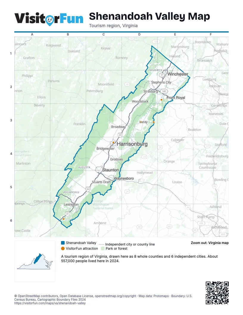
Highway index of Shenandoah Valley
Each highway on the sheet and the grid squares it crosses.
- I-64B5, B6, C5
- I-66D2, E2
- I-81B5, B6, C3, C4, C5, D2, D3, E1, E2
- US 11B6, D3, E1
- US 17E2
- US 33C4, D4
- US 48D2
- US 50E2
- US 60B5, B6
- US 211D3
- US 250B4, C4
- US 340D3, E2
- US 501B6
- US 522D1, E1, E2
- VA 7E2
- VA 37E1, E2
- VA 42C4
- VA 55D2
- WV 55D2
- VA 127D1
- WV 127D1
- VA 130B6
- VA 262C4, C5
- SR 612C4
- SR 655C4
- SR 721C4
Things to do on the Shenandoah Valley map
- Edinburg Mill
- Edith J. Carrier Arboretum
- Endless Caverns
- Frontier Culture Museum of Virginia
- Gimlet Ridge Overlook
- Grand Caverns
- Hardesty-Higgins House Visitor Center
- Josephine City School
- Luray Caverns
- Natural Bridge State Park
- Seven Bends State Park
- Shenandoah Caverns
- Shenandoah National Park
- Skyline Caverns
- Valley Mall
- Winchester National Cemetery
Places on the map
- Bridgewater
- Broadway
- Front Royal
- Grottoes
- Harrisonburg
- Lexington
- Luray
- Staunton
- Stephens City
- Strasburg
- Stuarts Draft
- Waynesboro
- Winchester
- Woodstock
Next to Shenandoah Valley
- Central Virginia map
- Northern Virginia map
- Virginia Mountains map
- Eastern Panhandle
- Potomac Highlands
© OpenStreetMap contributors, Open Database License, openstreetmap.org/copyright · Map data: Protomaps · Boundary: U.S. Census Bureau, Cartographic Boundary Files 2024