

Wisconsin map
Madison Metro Area map
The sheet's index lists 15 highways; US 151, I-39 and I-90 cross the most grid squares. Things to do inside the boundary: Blue Mound State Park, Capital Springs State Recreation Area and Cave of the Mounds. Also on it: Columbus, DeForest and Dodgeville.
Open the map (PDF, US Letter)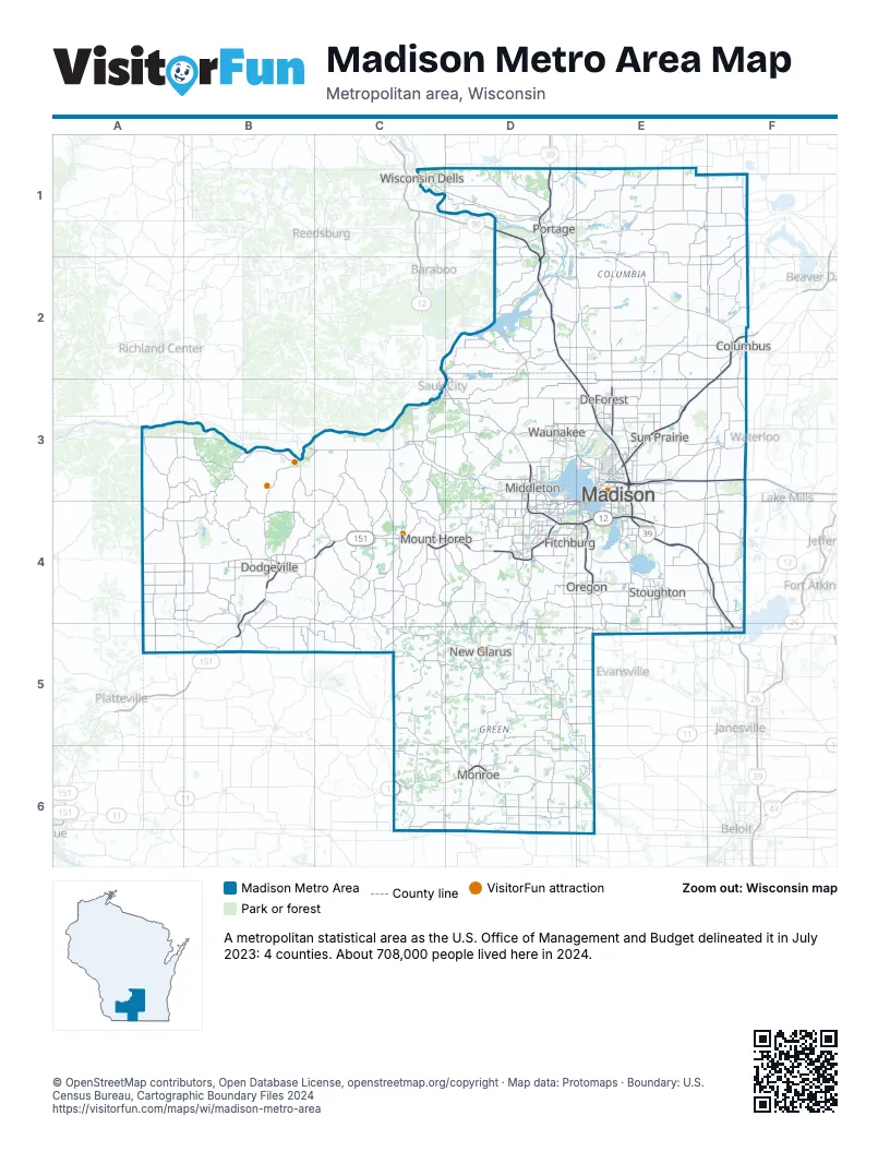
Highway index of Madison Metro Area
Each highway on the sheet and the grid squares it crosses.
- I-39D1, D2, E3, E4, F4, F5
- I-90D1, D2, E3, E4, F4, F5
- I-94D1, D2, E3, F3
- US 12C3, D3, D4, E4, F4
- US 14D3, D4, E4
- US 18B4, C4, D4, E4, F4
- US 51D1, E3, F4
- US 151B4, B5, C4, D4, E3, E4, F2, F3
- WI 11C6, D6, E6
- WI 19D3
- WI 23B4
- WI 30E3
- WI 69D6
- WI 78C3, D1, D2, D3
- WI 81D6, E6
Things to do on the Madison Metro Area map
- Blue Mound State Park
- Capital Springs State Recreation Area
- Cave of the Mounds
- Chazen Museum of Art
- Dells Boat Tours
- Goose Lake State Wildlife Area
- Governor Nelson State Park
- Henry Vilas Zoo
- Ice Age National Scenic Trail
- L. R. Ingersoll Physics Museum
- Lake Kegonsa State Park
- Little Amerricka
- Madison Children's Museum
- National Mustard Museum
- New Glarus Brewing Company
- New Glarus Woods State Park
- Olbrich Botanical Gardens
- Overture Center for the Arts
- Pendarvis
- Taliesin
- The House on the Rock
- Tower Hill State Park
- University of Wisconsin–Madison Arboretum
- West Towne Mall
Places on the map
- Columbus
- DeForest
- Dodgeville
- Fitchburg
- Madison
- Middleton
- Monroe
- Mount Horeb
- New Glarus
- Oregon
- Portage
- Stoughton
- Sun Prairie
- Waunakee
- Wisconsin Dells
© OpenStreetMap contributors, Open Database License, openstreetmap.org/copyright · Map data: Protomaps · Boundary: U.S. Census Bureau, Cartographic Boundary Files 2024