

Georgia map
Chatham County map
About 307,336 people live here (Census Bureau, 2024 estimate). The sheet's index lists 9 streets; Jim Gillis Historic Savannah Parkway, Harry Truman Parkway and Atlantic Coastal Highway cross the most grid squares. Things to do inside the boundary: Bonaventure Cemetery, Cathedral Basilica of St. John the Baptist and Forsyth Park.
Open the map (PDF, US Letter)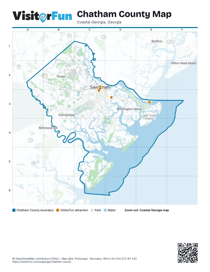
Street index of Chatham County
Each street on the sheet and the grid squares it crosses.
- Jim Gillis Historic Savannah ParkwayA2, B2, C2, B3, C3
- Atlantic Coastal HighwayC2, C3
- Harry Truman ParkwayC2, D2, C3, D3
- Jimmy Deloach ConnectorC2
- Jimmy Deloach ParkwayC2
- William F. Lynes ParkwayC2, C3
- Abercorn Street ExtensionB3, C3
- Veterans ParkwayB3, C3
- Abercorn StreetC3
Things to do on the Chatham County map
Places on the map
- Amazon
- Back River Beach
- Bacon Park Golf Course
- Bloomingdale
- Blue Bank Creek
- Blue Sky Preserve
- Bradley Pointe South
- Chatham County
- Coldbrook Swamp
- Colonial Grand at Hammocks
- CreekFire RV Resort
- Crosswinds Golf Club
- Dean Forest Landfill
- Deer Creek
- Delegal Creek
- Dutch Island
- Elba Island LNG Facility
- Ella Island
- Flora Hammock
- Forrest Hill
- Fort Pulaski National Monument
- Fort Screven Historic District
- Garden City
- Georgetown
- Great Ogeechee Lakes
- Green Island
- Gulfstream Aerospace
- Halcyon Bluff Subdivision
- Harveys Island
- Henderson
- Horse Pen Swamp
- Imperial Sugar
- International Paper
- Isle of Hope
- King's Island Turning Basin
- L. Scott Stell Park
- Little Don Island
- Little Tybee Sandbar
- Magnolia
- Marshwood
Next to Chatham County
- Bluffton
- Hilton Head Island
- Richmond Hill
© OpenStreetMap contributors (ODbL) · Map data: Protomaps · Boundary: Who's On First (CC-BY 4.0)