

Massachusetts map
Hampden County map
About 464,151 people live here (Census Bureau, 2024 estimate). The sheet's index lists 6 streets; Massachusetts Turnpike, Henry E Bodurtha Highway and Riverdale Street cross the most grid squares. Things to do inside the boundary: Canna Provisions, Holyoke Mall and Naismith Basketball Hall of Fame.
Open the map (PDF, US Letter)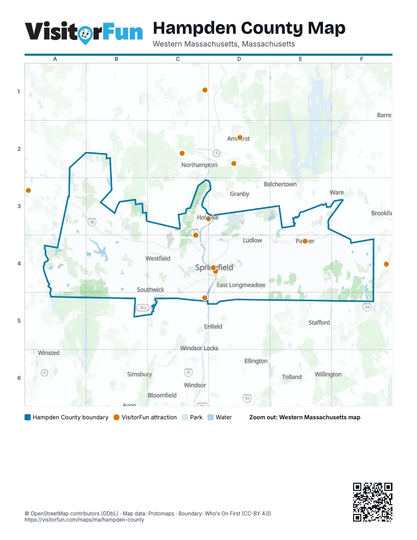
Maps inside Hampden County
1 map inside, from the street map of Hampden County down.
Street index of Hampden County
Each street on the sheet and the grid squares it crosses.
- Massachusetts TurnpikeA3, B3, E3, F3, B4, C4, D4, E4, F4
- Henry E Bodurtha HighwayC4, D4
- Riverdale StreetC4, D4
- South End BridgeD4
- Springfield ExpresswayD4
- Wilbur Cross HighwayF5
Things to do on the Hampden County map
Places on the map
- (3.5-mile loop)
- Agawam
- Arms Acres
- Ashley Pond
- Ashley Watershed
- Barber Memorial Camp
- Barnes Air National Guard Base
- Bear Hole Resevoir
- Bear Hole Watershed
- Blair Pond
- Blandford
- Blunt Park
- Boisseau
- Bonnieventure Farms I
- Bonnieventure Farms Ii
- Borden Brook Reservoir
- Boulder Hill
- Boy Scout Camp
- Boys Club
- Brimfield
- Brimfield State Forest
- Brzoska
- Burleigh Park
- C&S Wholesale Grocers
- Cabotville Industrial Park
- Camp Ramah Of New England
- Camp Stanica
- Chester
- Chester-Blandford State Forest
- Chicopee
- Chicopee Country Club
- Chicopee Memorial State Park
- Chicopee River Reservoir
- Chicoyne Parcel
- Cobble Mountain Reservoir
- Congamond Lakes Middle Pond
- Congamond Lakes South Pond
- Connecticut River Frontage
- Cooley Lake
Next to Hampden County
- Amherst
- Avon
- Barre
- Belchertown
- Bloomfield
- Brookfield
- Easthampton
- Ellington
- Enfield
- Granby
- Hatfield
- North Brookfield
- Northampton
- Simsbury
- Stafford
- Tolland
- Ware
- Willington
- Windsor
- Windsor Locks
- Winsted
© OpenStreetMap contributors (ODbL) · Map data: Protomaps · Boundary: Who's On First (CC-BY 4.0)