

Maryland map
Montgomery County map
About 1,082,273 people live here (Census Bureau, 2024 estimate). The sheet's index lists 8 streets; Eisenhower Memorial Highway, Intercounty Connector and Cabin John Parkway cross the most grid squares. Things to do inside the boundary: Glenstone.
Open the map (PDF, US Letter)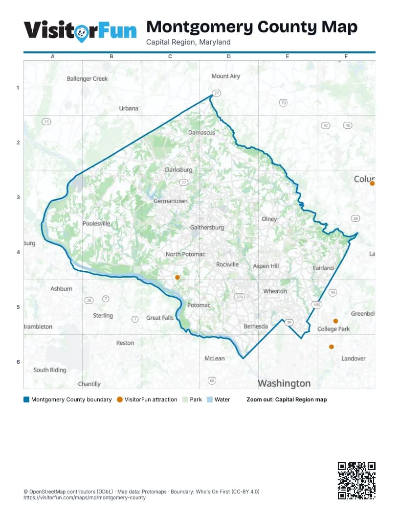
Street index of Montgomery County
Each street on the sheet and the grid squares it crosses.
- Eisenhower Memorial HighwayC2, C3, C4, D4
- Washington National PikeC2
- Intercounty ConnectorD4, E4, F4
- Metro Access RoadD4
- Redland ExtensionD4
- Sam Eig HighwayD4
- Cabin John ParkwayD5, D6
- Capital BeltwayD5, E5
Things to do on the Montgomery County map
Places on the map
- Agricultural History Farm Park
- Argyle Country Club
- Asbury Methodist Village
- Ashton Pond
- Ashton-Sandy Spring
- Aspen Hill
- Barnesville
- Belward Farm
- Bentley Park
- Bethesda
- Bethesda Country Club
- Black Hill Regional Park
- Blue Mash Golf Course
- Booze Creek Stream Valley Park
- Bretton Woods Golf Course
- Brookeville
- Brookmont
- Buck Branch Stream Valley Park
- Bucklodge Conservation Park
- Burning Tree Country Club
- Burnt Mills
- Burtonsville
- Cabin Branch
- Cabin John
- Cabin John Regional Park
- Cabin John Stream Valley Park
- Callithea Farm Special Park
- Calverton
- Carson Farm Special Park
- Charley Forest
- Chesapeake and Ohio Canal
- Chesapeake and Ohio Canal National Historical Park
- Chevy Chase
- Chevy Chase Club
- Chevy Chase View
- Chevy Chase Village
- Clarksburg
- Clarksburg Premium Outlets
- Cliftonbrook
- Clopper Lake
Next to Montgomery County
- Ashburn
- Ballenger Creek
- Brambleton
- Calverton
- Chantilly
- College Park
- Columbia
- Great Falls
- Greenbelt
- Hyattsville
- Landover
- McLean
- Mount Airy
- Reston
- South Riding
- Sterling
- Urbana
- Vienna
- Washington
© OpenStreetMap contributors (ODbL) · Map data: Protomaps · Boundary: Who's On First (CC-BY 4.0)