

Maine map
Cumberland County map
About 313,809 people live here (Census Bureau, 2024 estimate). The sheet's index lists 5 streets; Maine Turnpike, Falmouth Spur and Samantha Smith Way cross the most grid squares. Things to do inside the boundary: Freeport, L.L.Bean Flagship Store and Maine State Music Theatre.
Open the map (PDF, US Letter)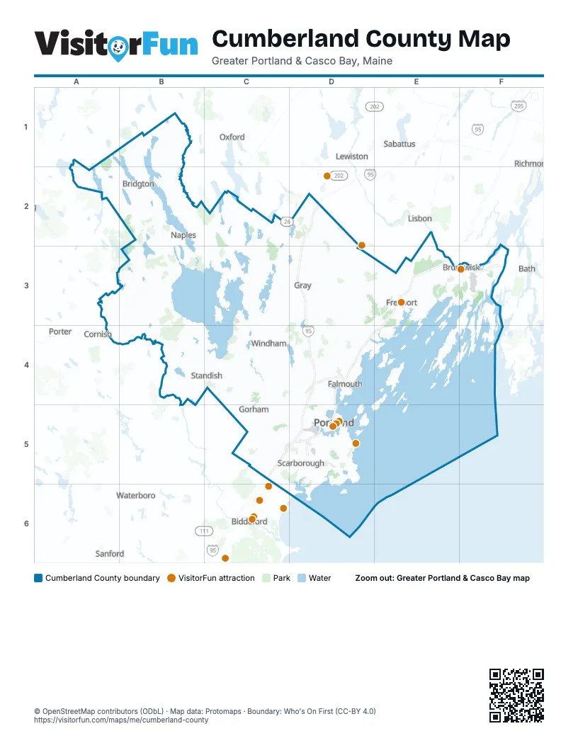
Street index of Cumberland County
Each street on the sheet and the grid squares it crosses.
- Maine TurnpikeD2, D3, D4, C5, D5
- Falmouth SpurD4
- Samantha Smith WayD5
- Scarborough ConnectorD5
- Tukey's BridgeD5
Things to do on the Cumberland County map
Places on the map
- Acres of Wildlife
- Alan E. Hutchinson Wildlife Management Area
- Arnold Family Forest
- Austin Cary Tree Farm
- Back Cove Trail South park
- Bald Pate Mountain Preserve
- Baldwin
- Bangs Island
- Bates Island
- Bay Bridge Estates
- Bayley's Camping Resort
- Bear Paw
- Beaver Pond
- Birch Island
- Black Brook Preserve
- Blackstrap Hill Preserve
- Bliss Woods
- Bonny Eagle Pond
- Bradbury Mountain State Park
- Bradbury-Pineland Corridor
- Brandy Brook Quarry
- Brandy Pond
- Bridgton
- Broadturn Farm
- Browns Pond
- Brunswick
- Brunswick Golf Club
- Brunswick Industrial Park
- Bustins Island
- Calderwood Preserve
- Camp Micah
- Cape Elizabeth
- Casco
- Casco Bay
- Cemetery Woodlot
- Chandler Brook Preserve
- Chandler Mill Pond
- Chandler Mill Woodlot
- Chase Reserve
- Chebeague Island
Next to Cumberland County
- Bath
- Biddeford
- Cornish
- Lewiston
- Lisbon
- Mechanic Falls
- Oxford
- Porter
- Richmond
- Sabattus
- Saco
- Sanford
- Waterboro
© OpenStreetMap contributors (ODbL) · Map data: Protomaps · Boundary: Who's On First (CC-BY 4.0)