

Maine map
Maine map
Things to do inside the boundary: Acadia National Park, Aquaboggan Waterpark and Aroostook County. Also on it: Alan E. Hutchinson Wildlife Management Area, Allagash Wilderness Waterway and Appalachian National Scenic Trail. Just past the edge: Bathurst, Concord and Digby.
Open the map (PDF, US Letter)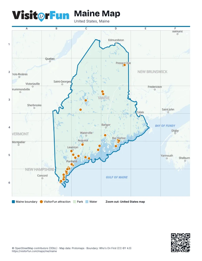
Maps inside Maine
3 maps inside, from the street map of Maine down.
Things to do on the Maine map
- Acadia National Park
- Aquaboggan Waterpark
- Aroostook County
- Bass Harbor Head Light Station
- Baxter State Park
- Cadillac Mountain
- Camden Hills State Park
- Coastal Maine Botanical Gardens
- Crab Apple Whitewater
- Downeast Acadia
- Farnsworth Art Museum
- Fort Knox State Historic Site
- Freeport
- Funtown Splashtown USA
- HatTrick Fishing Charters
- Intown Trolley
- L.L.Bean Flagship Store
- Maine Beaches Region Visitor Information Center
- Maine Camping
- Maine State Music Theatre
- Maine Tourism Association
- Maine's Lakes & Mountains
- Maine's MidCoast & Islands
- Marginal Way
- Moosehead Lake
- Mount Katahdin
- Nubble Lighthouse
- Ogunquit Playhouse
- Old Orchard Beach
- Old Port
- Palace Playland
- Pemaquid Point Lighthouse
- Penobscot Narrows Bridge and Observatory
- Portland Head Light
- Portland Museum of Art
- Portland Schooner Co.
- Raptor Falls Mini Golf & Ice Cream
- Saco
- Seashore Trolley Museum
- The Holy Donut
- Victoria Mansion
- Wells
- York's Wild Kingdom
- Yummies Candy & Nuts
Places on the map
- Acadia National Park
- Alan E. Hutchinson Wildlife Management Area
- Allagash Wilderness Waterway
- Appalachian National Scenic Trail
- Barnard Forest
- Baxter State Park
- Bigelow Preserve
- Downeast Lakes Community Forest
- Duck Lake Public Reserved Land
- Holeb Public Reserved Land
- Katahdin Iron Works
- Katahdin Woods and Waters National Monument
- Machias River Corridor Public Lands
- Pingree Conservation Easement
- Rachel Carson National Wildlife Refuge
- Reed Forest
- Roach Ponds
- Seboeis Public Reserved Land
- Seboomook Lake Public Reserved Land
- Telos Public Reserved Land
- Umbagog National Wildlife Refuge
- Upper St. John River Forest
Next to Maine
- Bathurst
- Concord
- Digby
- Drummondville
- Edmundston
- Fredericton
- Lowell
- Montpelier
- Québec
- Saint John
- Saint-Georges
- Shelburne
- Sherbrooke
- Trois-Rivières
- Victoriaville
- Yarmouth
© OpenStreetMap contributors (ODbL) · Map data: Protomaps · Boundary: Who's On First (CC-BY 4.0)