

Minnesota map
Dakota County map
About 453,156 people live here (Census Bureau, 2024 estimate). The sheet's index lists 8 streets; Crosstown Highway, Cedar Avenue and Senator Jim Metzen Memorial Highway cross the most grid squares. Things to do inside the boundary: Eagan and Minnesota Zoo.
Open the map (PDF, US Letter)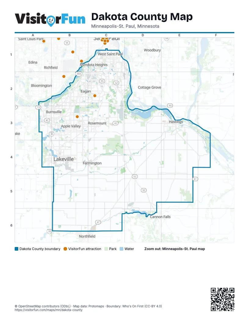
Street index of Dakota County
Each street on the sheet and the grid squares it crosses.
- Crosstown HighwayB1, C1
- Floyd B. Olson Memorial Highway/Hiawatha Pioneer TrailB1
- Lafayette FreewayC1
- Wakota BridgeD1
- Cedar AvenueB2, B3
- Courthouse Boulevard EastC2
- Rochester BoulevardD5
- Senator Jim Metzen Memorial HighwayD5, D6
Things to do on the Dakota County map
Places on the map
- Alimagnet Lake
- Alimagnet Park
- Amber Fields Park
- Apple Ponds
- Apple Valley
- Apple Valley Business Campus
- Ardmor Village
- Argenta Hills
- Augusta Lake
- Avonlea
- Barton Sand & Gravel
- Bde Ṡkaŋ Hiŋ Hdeṡka
- Bellwood Oaks Golf Course
- Berres Ridge
- Black Dog Lake
- Black Dog Park
- Black Dog Plant
- Black Dog SNA
- Blackhawk Lake
- Blackhawk Park
- Brookshire
- Burnsville
- Burnsville Quarry
- Cannon Golf Club
- Cannon River
- Cari Park
- Carleton College
- Carriage Place
- Carroll's Woods
- Carrollwood Estates
- Caslano
- Castle Rock Township
- Cedar Highlands
- Cedar Hills
- Cedar Isle Estates
- Cemstone
- Central Farm Service
- Central Lakeville
- Charleswood
- Chateau Estates
Next to Dakota County
- Bloomington
- Cannon Falls
- Cottage Grove
- Edina
- Hopkins
- Northfield
- Prescott
- Richfield
- Saint Louis Park
- Saint Paul
- Savage
- Woodbury
© OpenStreetMap contributors (ODbL) · Map data: Protomaps · Boundary: Who's On First (CC-BY 4.0)