

Minnesota map
Washington County map
About 283,960 people live here (Census Bureau, 2024 estimate). The sheet's index lists 5 streets; Lake Boulevard, Highlands Trail North and Saint Croix Crossing cross the most grid squares. Things to do inside the boundary: ArtReach St. Croix.
Open the map (PDF, US Letter)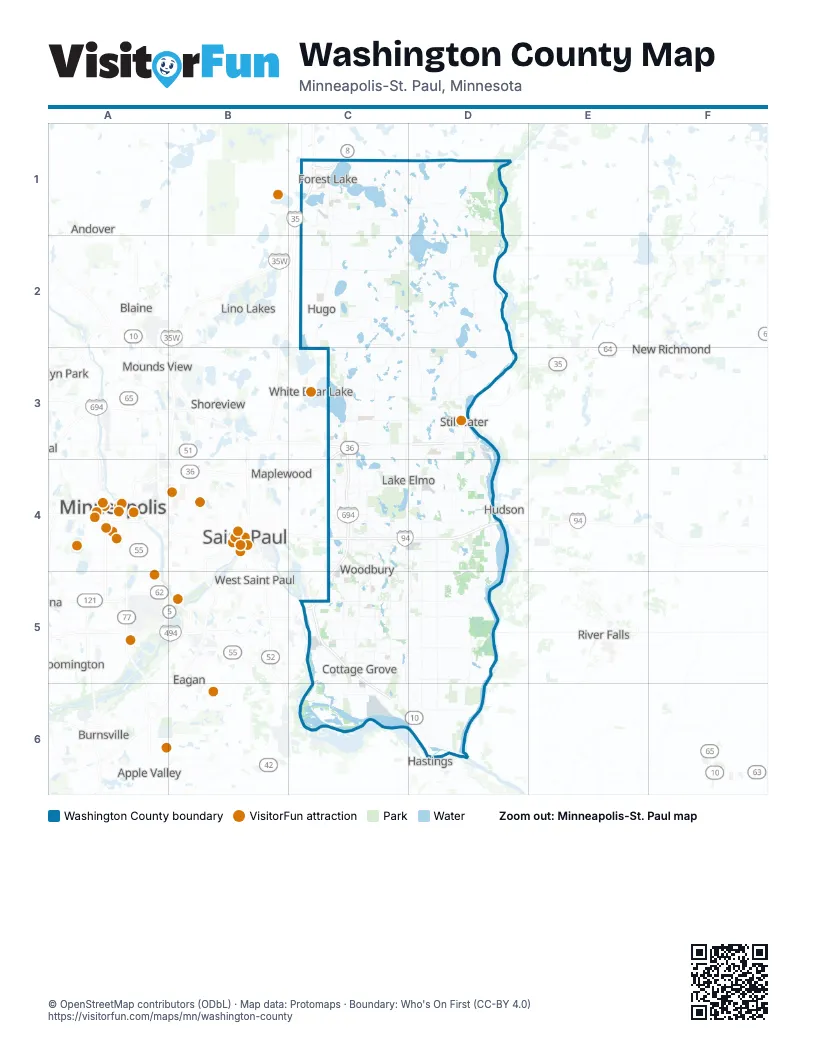
Street index of Washington County
Each street on the sheet and the grid squares it crosses.
- Lake BoulevardC1
- Highlands Trail NorthC3
- Saint Croix CrossingD3
- Hiawatha Pioneer Trail/Disabled American Veterans Highway/Voyageur HighwayC5
- Wakota BridgeC5
Things to do on the Washington County map
Places on the map
- 3M Cottage Grove
- Afton
- Afton Alps
- Afton State Park
- Allen S. King Power Plant
- Andy's Bark Park
- Bailey Nurseries
- Bailey's Arbor
- Baldwin Lake
- Barker Lake
- Barton Pit
- Bass Lake
- Battle Creek Lake
- Bayport
- Bayport Quarry
- Baytown Township
- Belwin Conservancy
- Big Carnelian Lake
- Big Marine Lake
- Big Marine Park Reserve
- Birchwood Village
- Bison Prairie
- Blackwoods Farm
- Bone Lake
- Boutwell Valley Estates
- Bridge View Park
- Bridlewood Farms
- Calarosa
- Camel's Hump Park
- Camp Lakamaga
- Carpenter Nature Center
- Carriage Farms
- Carriage Station
- Carver Lake Park
- Cedar Bluff
- CherryKnoll
- Cimarron
- City Centre
- CityPlace
- Clear Lake
Next to Washington County
- Andover
- Apple Valley
- Arden Hills
- Blaine
- Bloomington
- Brooklyn Park
- Burnsville
- Coon Rapids
- Eagan
- Fridley
- Ham Lake
- Hastings
- Hudson
- Inver Grove Heights
- Lino Lakes
- Maplewood
- Mendota Heights
- Minneapolis map
- Mounds View
- New Brighton
- New Richmond
- Prescott
- Richfield
- River Falls
- Rosemount
- Roseville
- Saint Paul
- Savage
- Shoreview
- South Saint Paul
- Vadnais Heights
- West Saint Paul
- White Bear Lake
© OpenStreetMap contributors (ODbL) · Map data: Protomaps · Boundary: Who's On First (CC-BY 4.0)