

Texas map
Galveston County map
About 367,407 people live here (Census Bureau, 2024 estimate). The sheet's index lists 4 streets; Gulf Freeway, South Gulf Freeway and Emmett F Lowry Expressway cross the most grid squares. Things to do inside the boundary: Artist Boat, Benno's Cajun Seafood and Bishop's Palace.
Open the map (PDF, US Letter)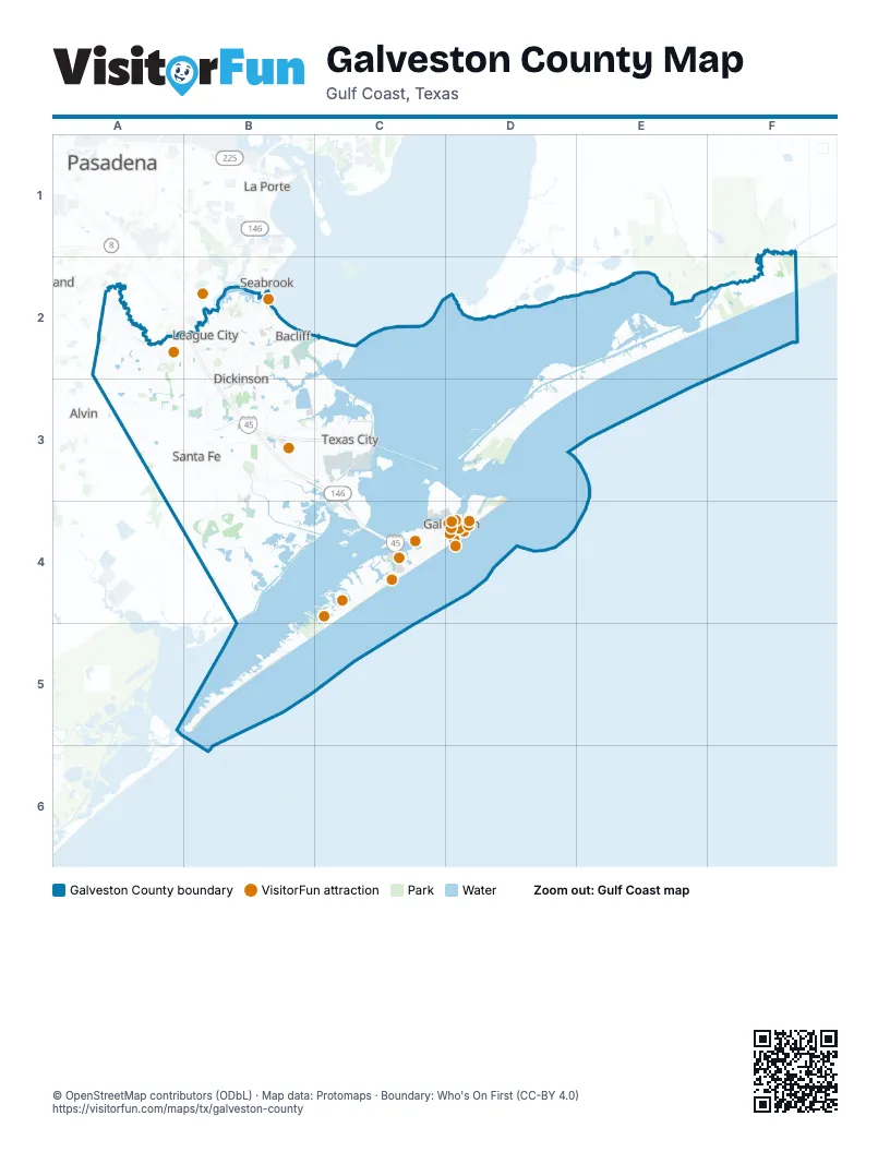
Street index of Galveston County
Each street on the sheet and the grid squares it crosses.
- North Gulf FreewayB2
- South Gulf FreewayB2, B3
- Emmett F Lowry ExpresswayB3, C3
- Gulf FreewayB3, C3, C4
Things to do on the Galveston County map
- Artist Boat
- Benno's Cajun Seafood
- Bishop's Palace
- Busters Old Time Photos
- Edward and Helen Oppenheimer Bird Observatory
- Galveston
- Galveston Duck Tours
- Galveston Helicopters
- Galveston Party Boats
- Galveston Railroad Museum
- Hal Newsom's Airboat Tours
- Juneteenth and Beyond Guided Tours
- Kemah Boardwalk
- La King's Confectionery
- League City
- Moody Gardens
- Nia Cultural Center
- Sandy Feet Sand Castle Services
- Seawall Interpretive Trail (Project SIT)
- The Grand 1894 Opera House
- The Strand Historic District
- Wave Dancer Charters
Places on the map
- Babe's Beach
- Bay Colony
- Bay Colony Pointe
- Bay Colony Pointe West
- Bay Harbor
- Bay Ridge
- Bay View
- Bay Water
- Bayou Vista
- Beacon Lakes Golf Club
- Bermuda Beach
- Biscayne Bay
- Bolivar Flats Shorebird Sanctuary
- Brittany Lakes
- Campbell Bayou Road
- Carancahua Lake
- Centerfield in Bay Colony
- Centerpointe
- Claremont Park
- Clear Creek Village
- Clear Lake Shores
- Coastal Point
- Cowart Creek
- Dickinson
- Dow Chemical
- East Beach
- Emerald Beach
- Evia
- Friendswood
- Galveston Beach
- Galveston County
- Galveston Island State Park
- Genesis Texas City Terminal
- Greens Lake
- Hidden Lakes
- Hitchcock
- Horseshoe Lake
- Horseshoe Marsh
- Horseshoe Marsh Bird Sanctuary
- Indian Beach
Next to Galveston County
- Alvin
- Deer Park
- La Porte
- Pasadena
- Seabrook
- South Houston
- Webster
© OpenStreetMap contributors (ODbL) · Map data: Protomaps · Boundary: Who's On First (CC-BY 4.0)