

Massachusetts map
Norfolk County map
About 740,754 people live here (Census Bureau, 2024 estimate). The sheet's index lists 12 streets; Yankee Division Highway, Amvets Highway and Pilgrim Highway cross the most grid squares. Things to do inside the boundary: Adams National Historical Park, Bass Pro Shops and Gillette Stadium.
Open the map (PDF, US Letter)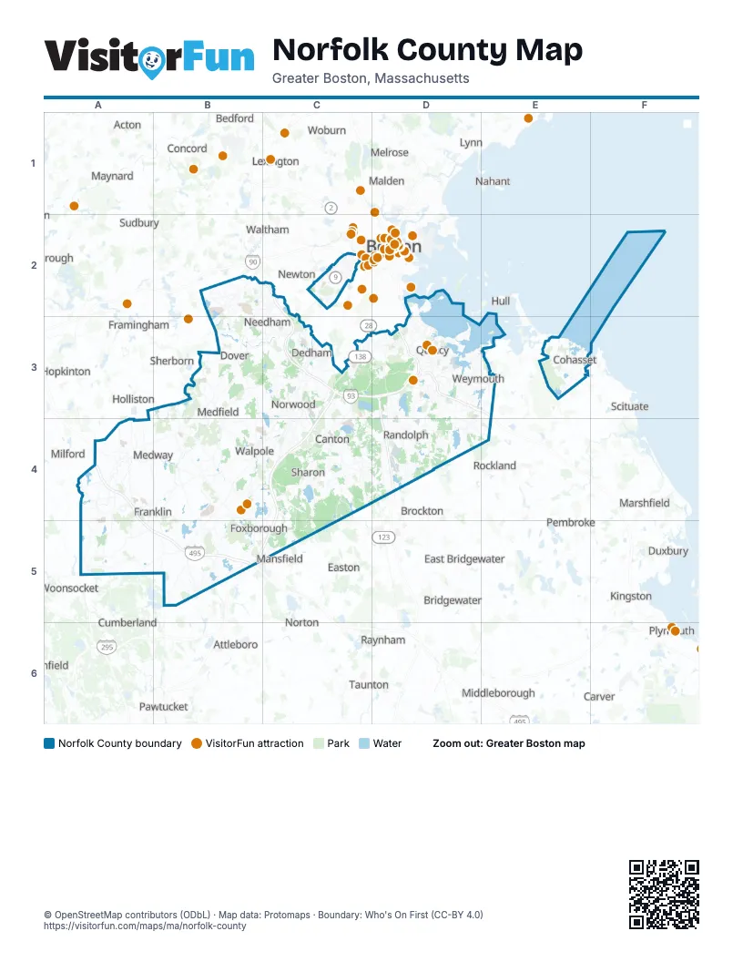
Street index of Norfolk County
Each street on the sheet and the grid squares it crosses.
- Yankee Division HighwayB2, C2, C3, D3
- Massachusetts TurnpikeC2
- Blue Hill DriveC3
- Amvets HighwayD3, D4
- Pelgrims HighwayD3
- Pilgrim HighwayD3, E3
- Pilgrims HighwayD3
- Pulgrims HighwayD3
- Ramp-rt 93 Nb To Rt 3 SbD3
- Sergeant William G. Walsh Memorial ExpresswayD3
- Southeast ExpresswayD3
- Southeast Expressway HOV LaneD3
Things to do on the Norfolk County map
Places on the map
- 55 Neponset Avenue
- Aaron River Reservoir
- Adams Farm
- Adams Farm Preserve
- Allandale Farm
- Along Pequit Brook
- Ames Long Pond
- Ames Rifle & Pistol Club
- Apple Knoll Farm
- Avalon Cohasset
- Avalon Quincy
- Avon
- Avon Industrial Park
- Avon Reservoir
- Bear Swamp
- Bear Swamp Conservation Area
- Beaver Brook Watershed Land
- Beaver Pond
- Bellingham
- Bellingham Harmony
- Billings Brook Gavins Pond Lan
- Birchwold Farm
- Bird Street Conservation Land
- Blacks Creek
- Blue Hill Country Club
- Blue Hills Reservation
- Borderland State Park
- Boston Harbor Islands National Recreation Area
- Bradford Torrey Bird Sanctuary
- Braintree
- Braintree Rifle & Pistol Club
- Braintree Town Forest
- Brass Kettle Conservation Area
- Bridge Island Meadows
- Bristol Blake State Res
- Broad Meadow
- Brookline
- Brookmeadow Country Club
- Burnt Swamp
Next to Norfolk County
- Abington
- Acton
- Ashland
- Attleboro
- Bedford
- Blackstone
- Boston map
- Bridgewater
- Brockton
- Cambridge
- Carver
- Chelsea
- Concord
- Cumberland
- Duxbury
- East Bridgewater
- Easton
- Framingham
- Hanson
- Hingham
- Holliston
- Hopkinton
- Hull
- Kingston
- Lexington
- Lincoln
- Lynn
- Malden
- Mansfield
- Marshfield
- Maynard
- Medford
- Melrose
- Middleborough
- Milford
- Nahant
- Natick
- Newton
- North Attleborough
- Norton
- Pawtucket
- Pembroke
- Plymouth
- Raynham
- Revere
- Rockland
- Saugus
- Scituate
- Sherborn
- Southborough
- Sudbury
- Taunton
- Waltham
- Watertown
- Wayland
- West Bridgewater
- Woburn
- Woonsocket
© OpenStreetMap contributors (ODbL) · Map data: Protomaps · Boundary: Who's On First (CC-BY 4.0)