

New Jersey map
Skylands Region map
The sheet's index lists 15 highways; US 206, I-80 and NJ 23 cross the most grid squares. Things to do inside the boundary: Acorn Hall, Bamboo Brook Outdoor Education Center and Boonton Historical Society and Museum. Also on it: Hampton Township, Hopatcong and Long Hill Township.
Open the map (PDF, US Letter)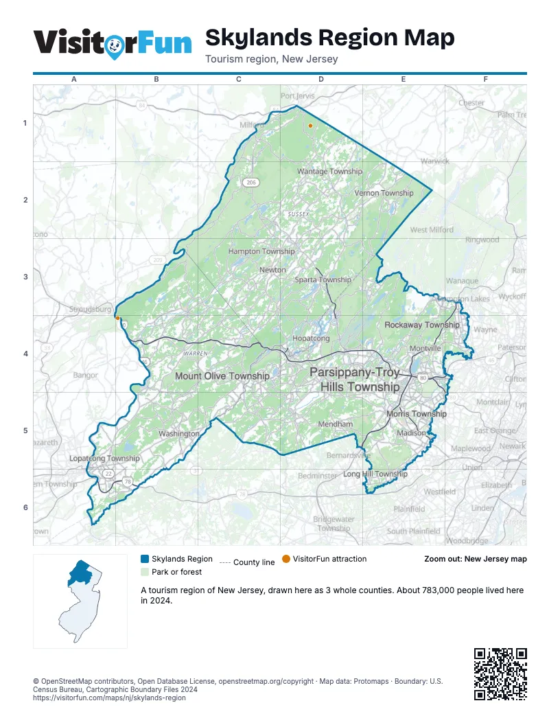
Highway index of Skylands Region
Each highway on the sheet and the grid squares it crosses.
- I-78A6, B6
- I-80A4, B4, C4, D4, E4, F4
- I-280E4, F4, F5
- I-287D5, E4, E5, F3, F4
- US 22A5, A6, B6
- US 46B4, B5, D4, E4, F4
- US 206C1, C2, C3, C4, D2, D3, D4, D5
- NJ 10D4, E4, E5
- NJ 15D2, D3, D4
- NJ 23D1, D2, D3, E3, F3, F4
- NJ 24E5
- NJ 31B5
- NJ 94C3, D3
- NJ 173A6, B6
- PA 611A6
Things to do on the Skylands Region map
- Acorn Hall
- Bamboo Brook Outdoor Education Center
- Boonton Historical Society and Museum
- Delaware Water Gap National Recreation Area
- Elias Van Bunschooten House
- Elizabeth D. Kay Environmental Center
- Frelinghuysen Arboretum
- High Point State Park
- Lake Hopatcong Historical Museum
- Mahlon Dickerson Reservation
- Morris Museum
- Morristown National Historical Park
- Museum of Early Trades and Crafts
- Rockaway Townsquare
- Sterling Hill Mining Museum
- Tourne County Park
- Washington's Headquarters Museum
- Wawayanda State Park
- Willowwood Arboretum
Places on the map
- Hampton Township
- Hopatcong
- Long Hill Township
- Lopatcong Township
- Madison
- Mendham
- Montville
- Morris Township
- Mount Olive Township
- Newton
- Parsippany-Troy Hills Township
- Rockaway Township
- Sparta Township
- Vernon Township
- Wantage Township
- Washington
Next to Skylands Region
- Central Jersey map
- Gateway Region map
- Hudson Valley
- Lehigh Valley
- Philadelphia and the Countryside
- Pocono Mountains
© OpenStreetMap contributors, Open Database License, openstreetmap.org/copyright · Map data: Protomaps · Boundary: U.S. Census Bureau, Cartographic Boundary Files 2024