

New York map
Monroe County map
About 752,202 people live here (Census Bureau, 2024 estimate). The sheet's index lists 13 streets; Western Expressway, New York State Thruway and Genesee Expressway cross the most grid squares. Things to do inside the boundary: The Strong National Museum of Play.
Open the map (PDF, US Letter)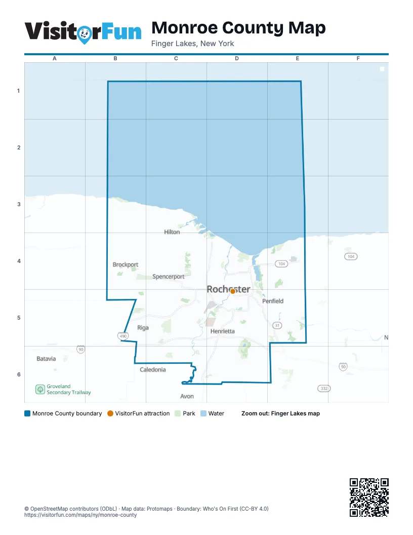
Maps inside Monroe County
1 map inside, from the street map of Monroe County down.
Street index of Monroe County
Each street on the sheet and the grid squares it crosses.
- Spencerport ExpresswayC4, C5
- Western ExpresswayC4, D4, B5, C5, D5
- IIrondequoit–Wayne County ExpresswayD4
- Inner LoopD4, D5
- Irondequoit–Wayne County ExpresswayD4, E4
- Keeler Street ExpresswayD4
- Outer LoopD4, D5
- Ridgeway AvenueD4
- West Ridge RoadD4
- Airport ExpresswayC5
- New York State ThruwayC5, D5, D6, E6
- Eastern ExpresswayD5, E5
- Genesee ExpresswayD5, C6, D6
Things to do on the Monroe County map
Places on the map
- Abraham Lincoln Park
- Arrowhead Golf Course & Marina
- Autumn Wood
- Bausch & Lomb Riverside Park
- Beatty Point
- Beechwood
- Black Creek Park
- Braddock Bay
- Braddock Bay Park
- Braddock Bay Wildlife Management Area
- Braemar Country Club
- Bright Oaks
- Brighton Town Landfill
- Brook-Lea Country Club
- Brookedale Preserve
- Browncroft
- Buck Pond
- Bushnell's Basin
- Canal Side Business Center
- Cedar Grove
- Chestnut
- Chestnut Heights
- Churchville East Golf Course
- Churchville Park
- Churchville West Golf Course
- City of Rochester
- Clarkson
- Cobb's Hill Park
- Corbett's Glen Nature Park
- Corn Hill
- Country Club of Perinton
- Country Club of Rochester
- Cranberry Pond
- Crystal Spring
- Deerfield Country Club
- Durand Eastman Golf Course
- Durand Eastman Park
- Eagle Vale Golf Club
- East Pittsford Manor
- Eastman Business Park
Next to Monroe County
- Avon
- Batavia
- Caledonia
© OpenStreetMap contributors (ODbL) · Map data: Protomaps · Boundary: Who's On First (CC-BY 4.0)