

New York map
Orange County map
About 411,767 people live here (Census Bureau, 2024 estimate). The sheet's index lists 4 streets; New York State Thruway, Newburgh-Beacon Bridge and Exit 1 (US 6, NJ Route 23)) cross the most grid squares. Things to do inside the boundary: Castle Fun Center, LEGOLAND New York Resort and Mount Peter.
Open the map (PDF, US Letter)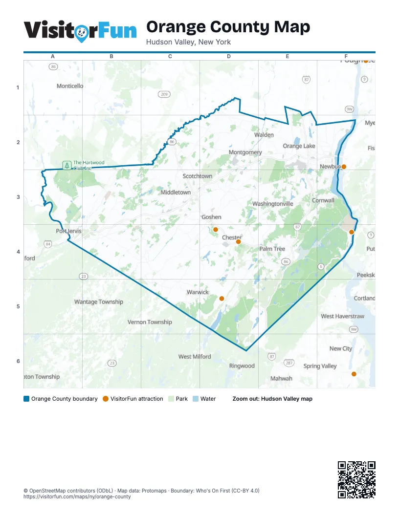
Maps inside Orange County
1 map inside, from the street map of Orange County down.
Street index of Orange County
Each street on the sheet and the grid squares it crosses.
- New York State ThruwayE2, E3, E4, E5
- Newburgh-Beacon BridgeF2
- Exit 1 (US 6, NJ Route 23))A4
- Palisades Interstate ParkwayF4
Things to do on the Orange County map
Places on the map
- Al Turi Landfill
- Appalachian National Scenic Trail
- Art's Milk Farm
- Balmville
- Beaver Dam Lake
- Beaverdam Lake
- Best Pheasantry
- Big Lake
- Black Meadow Club Inc
- Black Meadow Flora
- Black Rock Forest
- Blue Lake
- Blue Sky Sports Complex
- Bog Meadow Pond
- Browns Pond
- Buck Knoll Hunting Club Inc
- Cahoonzie Club, Inc
- Camp Lanowa
- Cascade Lake Park
- Celebrity Farms
- Chadeayne Woods
- Chadwick Lake
- Chester Industrial Complex
- Church of Crawford
- Circleville Park
- City of Middletown
- City of Newburgh
- City of Port Jervis
- Connor Farm Subdivision
- Cranberry Lake
- Cranberry Pond
- Cromwell Lake
- Daramo Dairy Farm
- Deerpark Dam
- Deerpark Rod & Gun Club
- Delaware Aqueduct Bypass
- Duck L'Ranch
- Dunning Plaza
- Earl Reservoir Park
- Elks-Brox Memorial Park
Next to Orange County
- Airmont
- Beacon
- Cortlandt
- Hampton Township
- Mahwah
- Marlboro
- Milford
- Monticello
- Mount Ivy
- New City
- New Square
- Nyack
- Peekskill
- Ringwood
- Spring Valley
- Stony Point
- Valley Cottage
- Vernon Township
- Viola
- Wantage Township
- West Haverstraw
- West Milford
© OpenStreetMap contributors (ODbL) · Map data: Protomaps · Boundary: Who's On First (CC-BY 4.0)