

Arkansas map
Pulaski County map
About 401,209 people live here (Census Bureau, 2024 estimate). The sheet's index lists 4 streets; East Belt Freeway, Financial Centre Parkway and Wilbur D. Mills Freeway cross the most grid squares. Things to do inside the boundary: Little Rock Central High School National Historic Site, Pinnacle Mountain State Park and River Market District.
Open the map (PDF, US Letter)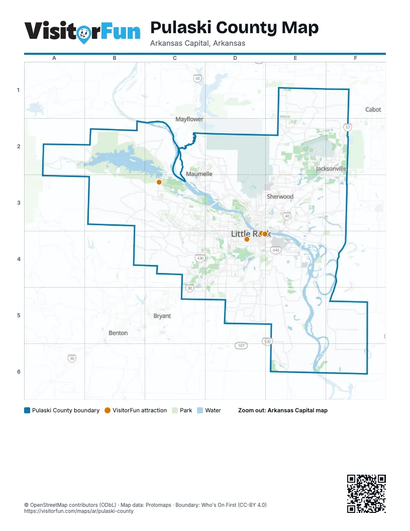
Street index of Pulaski County
Each street on the sheet and the grid squares it crosses.
- East Belt FreewayE3, D4, E4
- North Belt FreewayE3
- Financial Centre ParkwayC4, D4
- Wilbur D. Mills FreewayC4, D4
Things to do on the Pulaski County map
Places on the map
- Allsopp Park
- Amazon LIT2 Fulfillment
- Arkansas
- Arkansas State Fairgrounds
- Big Rock Settling Pond
- Big Rock Township
- Boyle Park
- Briarwood
- Brodie Creek
- Burns Park
- Burns Park Golf Course
- Cammack Village
- Chenal Country Club
- College Station
- Emerald Park
- Evergreen
- Faulkner Lake
- Forty Point Lake
- Gateway Town Center
- Gibson
- Gillam Park
- Gravel Ridge
- Harris Lake
- Hensley
- Hill Township
- Hindman Park
- Jacksonville
- Lake Kuykendall
- Lake Maumelle
- Lake Willastein
- Lake Willastein Park
- Lakewood Lake Number One
- Lakewood Lake Number Two
- Little Maumelle River
- Little Rock
- Little Rock Air Force Base
- LRAFB Ramp
- Maumelle
- Maumelle Park
Next to Pulaski County
- Benton
- Bryant
- Cabot
- Mayflower
© OpenStreetMap contributors (ODbL) · Map data: Protomaps · Boundary: Who's On First (CC-BY 4.0)