

Connecticut map
Eastern Connecticut map
The sheet's index lists 17 highways; I-395, I-95 and US 6 cross the most grid squares. Things to do inside the boundary: Argia, Beaver Brook State Park and Bluff Point State Park. Also on it: Colchester, Groton and Jewett City.
Open the map (PDF, US Letter)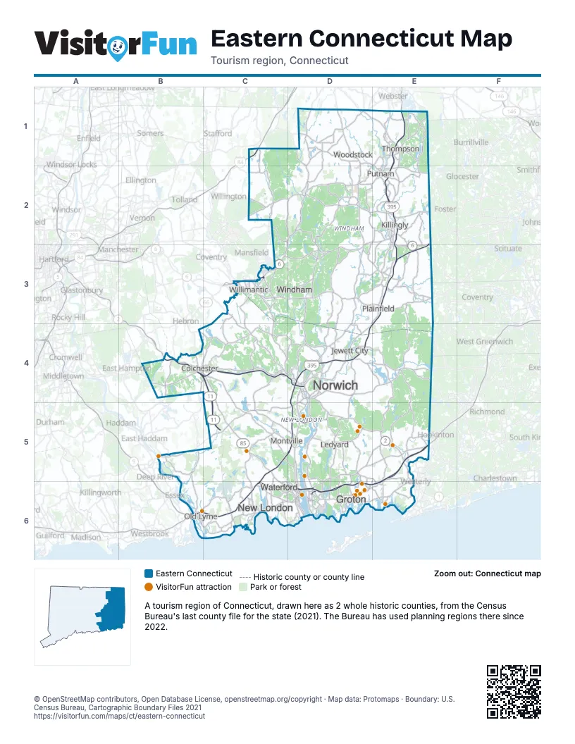
Highway index of Eastern Connecticut
Each highway on the sheet and the grid squares it crosses.
- I-84C1
- I-95B6, C6, D6, E5, E6
- I-395C5, C6, D4, D5, E1, E2, E3
- US 1B6, D6
- US 6C3, D2, D3, E2, E3
- CT 2B4, C4, D4, D5, E5
- CT 2AD4, D5
- CT 11B4, C4, C5
- CT 12D4, D5, D6, E2
- CT 32C3, C4, D4, D5, D6
- CT 66C3
- RI 78E5
- CT 82C5
- CT 85C5, C6
- CT 184D6
- CT 201E5
- CT 349D6
Things to do on the Eastern Connecticut map
- Argia
- Beaver Brook State Park
- Bluff Point State Park
- Connecticut College Arboretum
- Custom House Maritime Museum
- Day Pond State Park
- Florence Griswold Museum
- Foxwoods Resort Casino
- Gardner Lake State Park
- Gillette Castle State Park
- Haley Farm State Park
- Harkness Memorial State Park
- Hopeville Pond State Park
- Israel Putnam Wolf Den
- Lyman Allyn Art Museum
- Mashamoquet Brook State Park
- Mashantucket Pequot Museum and Research Center
- Mohegan Sun
- Mystic Aquarium
- Mystic Country
- Mystic Experience Co
- Mystic Knotwork
- Mystic Seaport Museum
- Nature's Art Village
- Ocean Beach Park
- Olde Mistick Village
- Rocky Neck State Park
- Scooter A Long
- Slater Memorial Museum
- Stoddard Hill State Park
- Stonington Harbor Light (Old Lighthouse Museum)
- Submarine Force Museum
- Thames River Heritage Park
- The Velvet Mill
- TreeTrails Adventures Mystic
- Windham Textile and History Museum
Places on the map
- Colchester
- Groton
- Jewett City
- Killingly
- Ledyard
- Montville
- New London
- Norwich
- Old Lyme
- Plainfield
- Putnam
- Thompson
- Waterford
- Willimantic
- Windham
- Woodstock
Next to Eastern Connecticut
- Central Connecticut map
- Central Massachusetts
- Blackstone Valley
- South County
- Warwick & West Bay
© OpenStreetMap contributors, Open Database License, openstreetmap.org/copyright · Map data: Protomaps · Boundary: U.S. Census Bureau, Cartographic Boundary Files 2021