

Connecticut map
Connecticut map
Things to do inside the boundary: Argia, Central Connecticut and Connecticut River Museum. Also on it: Airline State Park Trail (Northern Section), Airline State Park Trail (Southern Section) and Algonquin State Forest. Just past the edge: Beekman, Brentwood and Brookhaven.
Open the map (PDF, US Letter)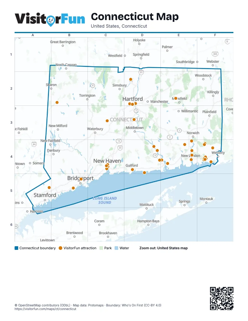
Maps inside Connecticut
2 maps inside, from the street map of Connecticut down.
Things to do on the Connecticut map
- Argia
- Central Connecticut
- Connecticut River Museum
- Connecticut Science Center
- Connecticut's Beardsley Zoo
- Dinosaur State Park
- Essex Steam Train & Riverboat
- Fairfield
- Florence Griswold Museum
- Foxwoods Resort Casino
- Frank Pepe Pizzeria Napoletana
- Gillette Castle State Park
- Goodspeed Opera House
- Guilford Fairgrounds
- Hammonasset Beach State Park
- It Adventure Ropes Course
- Kent Falls State Park
- Lake Compounce
- Louis' Lunch
- Mashantucket Pequot Museum and Research Center
- Mohegan Sun
- Mystic Aquarium
- Mystic Country
- Mystic Knotwork
- Mystic Seaport Museum
- Nature's Art Village
- New England Air Museum
- Public Art CT
- Scooter A Long
- Submarine Force Museum
- Thames River Heritage Park
- The Adventure Park at Storrs
- The Glass House
- The Mark Twain House & Museum
- The Velvet Mill
- TreeTrails Adventures Mystic
- Wadsworth Atheneum Museum of Art
- Yale Peabody Museum
- Yale University Art Gallery
Places on the map
- Airline State Park Trail (Northern Section)
- Airline State Park Trail (Southern Section)
- Algonquin State Forest
- American Legion State Forest
- Appalachian Trail Scenic Open Space
- Bantam River Preserve
- Barkhamsted Reservoir Watershed Reserve Land
- Bluff Point State Park
- Bradley International Airport
- Buckingham Reservoir Watershed
- Bull Hill Preserve
- City of Groton Watershed Lands
- City of New London Public Watershed Lands
- Cockaponset State Forest
- Colebrook Reservoir Watershed Reserve Land
- Connecticut Valley Railroad State Park Trail
- Deep River Reservoir Watershed
- Devils Den
- Enders State Forest
- Farmington Canal Line State Park Trail
- Gay City State Park
- Great Mountain Forest
- Hop River State Park Trail
- Housatonic State Forest
- I-291 Corridor
- James L. Goodwin State Forest
- John A. Minetto State Park
- Kent Falls State Park
- Lake Gaillard Watershed Reserve Land
- Lake of Isles
- Larkin State Park Trail
- Macedonia Brook State Park
- Mansfield Hollow State Park
- Mattatuck State Forest
- McLean Game Refuge
- Meshomasic State Forest
- Mohawk State Forest
- Mohegan State Forest
- Moosup Valley State Park Trail
- Nassahegon State Forest
Next to Connecticut
- Beekman
- Brentwood
- Brookhaven
- Coram
- Coventry
- East Fishkill
- East Patchogue
- Great Barrington
- Hampton Bays
- Harrison
- Holyoke
- Mattituck
- Montauk
- New Rochelle
- North Sea
- Palmer
- Pleasant Valley
- Shirley
- Somers
- Southbridge
- Spencer
- Springfield
- Springs
- Webster
- Westerly
- Westfield
- White Plains
- Yorktown
© OpenStreetMap contributors (ODbL) · Map data: Protomaps · Boundary: Who's On First (CC-BY 4.0)