

New Hampshire map
Rockingham County map
About 322,433 people live here (Census Bureau, 2024 estimate). The sheet's index lists 7 streets; Blue Star Turnpike, Alan Bartlett Shepard Junior Highway and Spaulding Turnpike cross the most grid squares. Things to do inside the boundary: Canobie Lake Park, Captain's Cove Adventure Golf and Granite State Whale Watch.
Open the map (PDF, US Letter)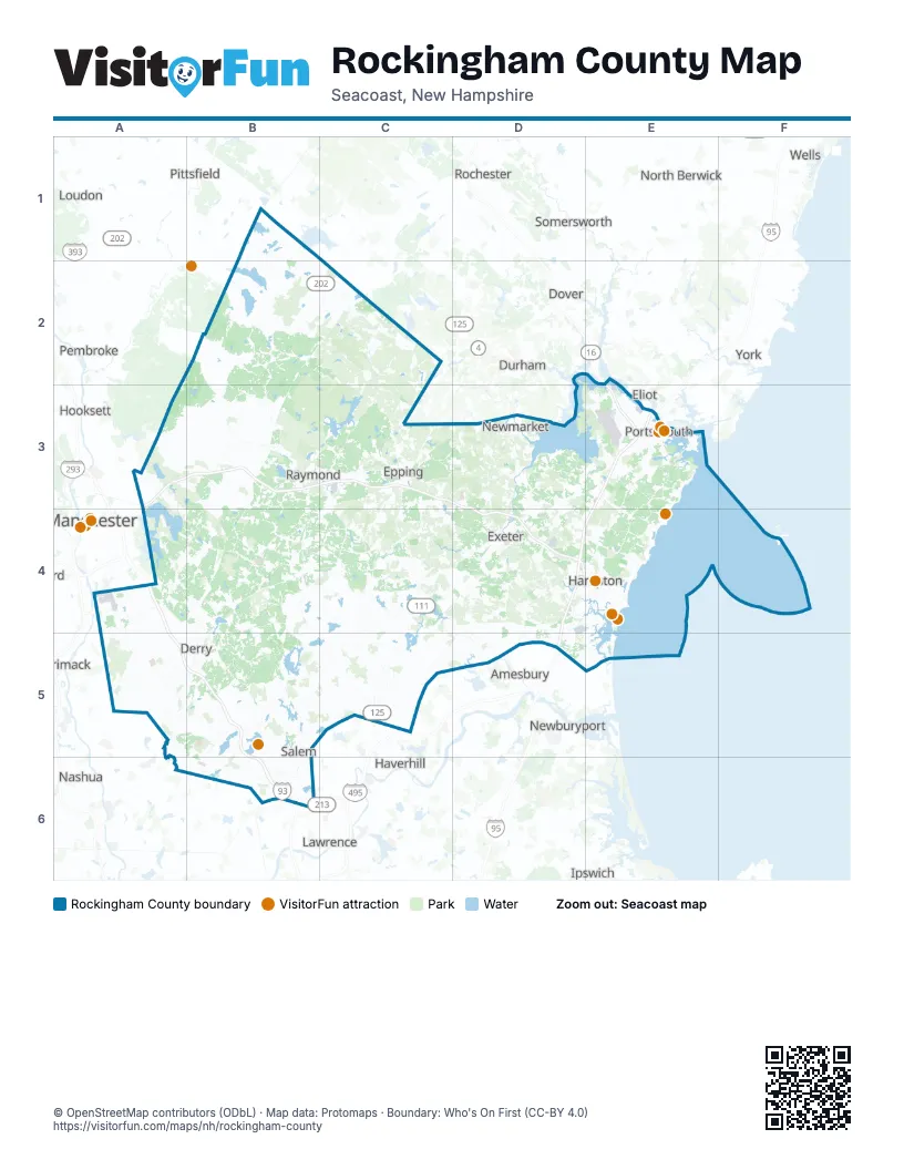
Street index of Rockingham County
Each street on the sheet and the grid squares it crosses.
- Blue Star TurnpikeE3, D4, E4, D5
- Spaulding TurnpikeE3
- Alan B Shepard HighwayA4
- Alan B Shepard Jr HighwayA4
- Alan Bartlett Shepard Junior HighwayA4, A5, B5
- Raymond Wieczorek DriveA4
- Exeter-Hampton ExpresswayD4
Things to do on the Rockingham County map
Places on the map
- Abe Emerson Marsh
- Abenaqui Country Club
- Academy Woods
- Acorn Town Forest
- Aggregate Industries
- Angle Pond
- Apple Hill Golf Club
- Appletree Road
- Arlington Mill Reservoir
- Arthur Chase Town Forest
- Atkinson
- Atkinson Resort & Country Club
- Auburn
- Auburn Road Landfill
- Autumn Woods
- Avery Estates
- Awcomin Marsh
- Ballard Pond
- Ballard State Forest
- Beaver Lake
- Beaver Pond
- Betty Meadows
- Big Island Pond
- Black Rock Creek
- Bliss Farm
- Boy Scouts Camp Wah-Tut-Ca
- Bramber Green
- Breakfast Hill Golf Club
- Brentwood
- Brentwood Recreation Area
- Brook Hollow Sand and Gravel
- Brookstone Park
- Brown Brook Forest
- Brown’s Woods Preserve
- Browns Island
- Burbank Woods Preserve
- Burley Farms
- Burnhams Marsh
- Busch Farm Conservation Area
Next to Rockingham County
- Amesbury
- Dover
- Durham
- Eliot
- Haverhill
- Hooksett
- Ipswich
- Kittery
- Lawrence
- Loudon
- Manchester
- Merrimack
- Methuen
- Nashua
- Newburyport
- North Berwick
- Pembroke
- Pittsfield
- Rochester
- Somersworth
- South Berwick
- Wells
- York
© OpenStreetMap contributors (ODbL) · Map data: Protomaps · Boundary: Who's On First (CC-BY 4.0)