

New York map
Capital-Saratoga map
The sheet's index lists 19 highways; I-87, I-90 and NY 7 cross the most grid squares. Things to do inside the boundary: Albany Institute of History & Art, Cherry Plain State Park and Clifton Park Center. Also on it: Albany, Bethlehem and Clifton Park.
Open the map (PDF, US Letter)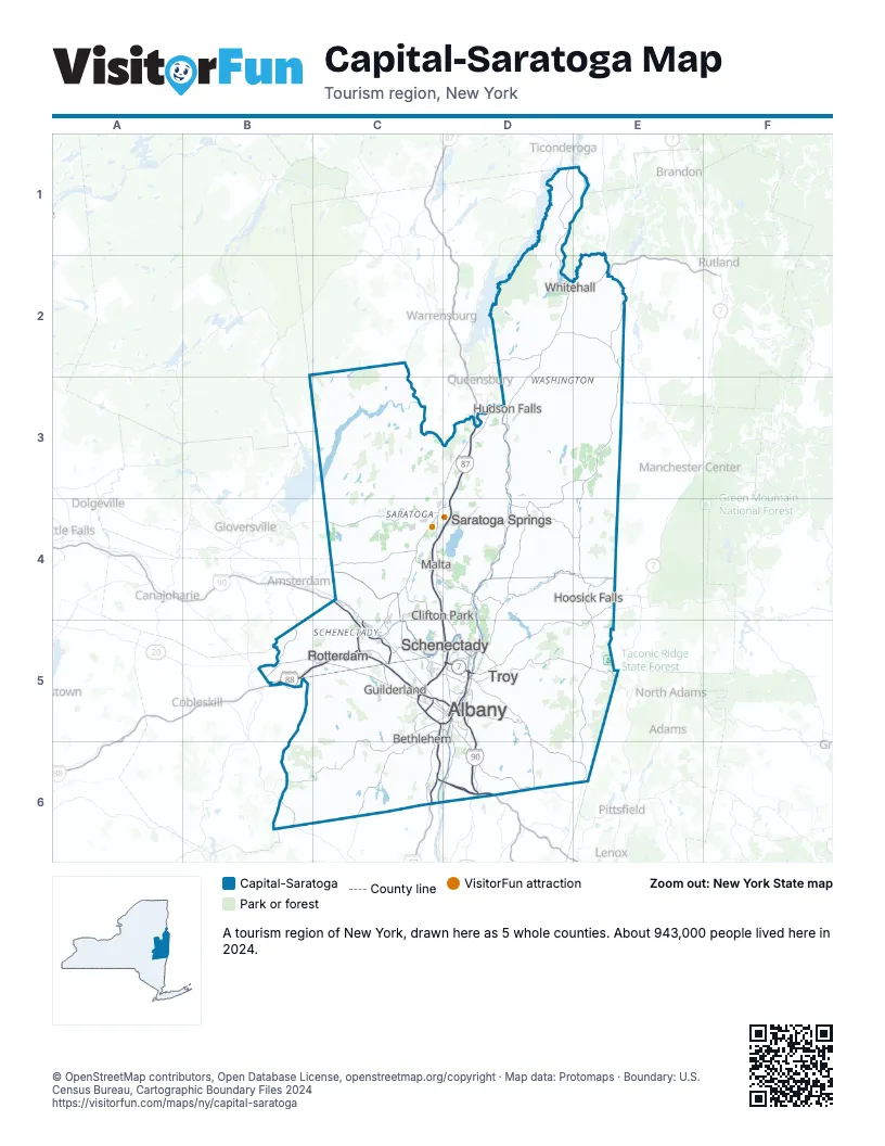
Highway index of Capital-Saratoga
Each highway on the sheet and the grid squares it crosses.
- I-87C4, C5, C6, D3, D4, D5
- I-88B5, C5
- I-90C4, C5, D5, D6
- I-787C5, D5
- I-890C5
- US 4D2, E2
- US 9C4, D4, D6
- US 20B5, C5, D6
- NY 7C5, D5, E4, E5
- NY 22D2, E4, E5
- NY 29C4
- NY 50C4, C5, D4
- NY 66D6
- NY 67C4
- NY 85C5
- NY 149D2
- VT 279E4
- NY 787D5
- NY 890C5
Things to do on the Capital-Saratoga map
- Albany Institute of History & Art
- Cherry Plain State Park
- Clifton Park Center
- Crailo State Historic Site
- Crossgates Mall
- Gerald B.H. Solomon Saratoga National Cemetery
- Grafton Lakes State Park
- Grant Cottage State Historic Site
- National Museum of Racing and Hall of Fame
- Saratoga Battle Monument
- Saratoga Casino and Raceway
- Saratoga Race Course
- Saratoga Spa State Park
- Schuyler Mansion State Historic Site
- Stuyvesant Plaza
- Thompson's Lake State Park
- USS Slater
- Viaport Rotterdam
- Wilton Mall
Places on the map
- Albany
- Bethlehem
- Clifton Park
- Guilderland
- Hoosick Falls
- Hudson Falls
- Malta
- Rotterdam
- Saratoga Springs
- Schenectady
- Troy
- Whitehall
Next to Capital-Saratoga
- Western Massachusetts
- Adirondacks map
- Central New York map
- Hudson Valley map
- The Catskills map
- Champlain Valley
- Stone Valley
- The Shires
© OpenStreetMap contributors, Open Database License, openstreetmap.org/copyright · Map data: Protomaps · Boundary: U.S. Census Bureau, Cartographic Boundary Files 2024