

New York map
Westchester County map
A printable two-page map of Westchester County (Hudson Valley, New York), drawn by VisitorFun from OpenStreetMap. Page two is the street index: every street on the sheet with its grid square, the same list as below.
Open the map (PDF, US Letter)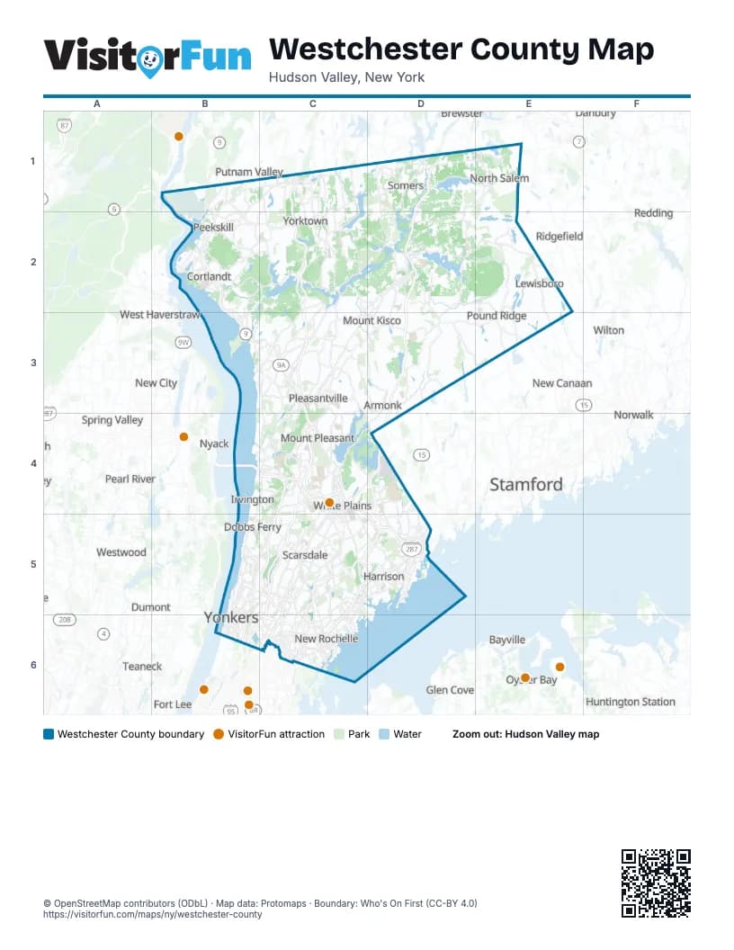
Street index of Westchester County
Each street on the sheet and the grid squares it crosses.
- Taconic State ParkwayC1, C2, C3, C4
- New York State ThruwayB4, C4, C5, B6, C6
- Cross Westchester ExpresswayC4, D5
- Sprain Brook ParkwayC4, C5
- Hutchinson River ParkwayD4, C5, D5, C6
- Merritt ParkwayD4
- Cross County ParkwayB5, C5, B6, C6
- Bronx River ParkwayC5, C6
- New England ThruwayC5, D5, C6
- Henry Hudson ParkwayB6
- Saw Mill River ParkwayB6
- Cross County Parkway (express lanes)C6
- Cross County Parkway (local lanes)C6
Things to do on the Westchester County map
Places on the map
- Amawalk Outlet Unit
- Amawalk Reservoir
- Angle Fly Preserve
- Angle Fly Unit
- Anglebrook Golf Club
- Apawamis Golf Club
- Ardsley Country Club
- Arthur Ketchum Sanctuary
- Baxter Preserve, The Racetrack
- Bedford
- Bedford Golf and Tennis Club
- Bedford Hills
- Betsy Sluder Nature Preserve
- Big Peninsula Unit
- Blind Brook Club
- Blue Heron Lake
- Blue Mountain Reservation
- Blue Mountain Sportsman Center
- Bonnie Briar Country Club
- Boutonville Swamp
- Brinton Brook Sanctuary
- Brownell Preserve
- Browns Reservoir
- Brynwood Golf & Country Club
- Burden Preserve
- Buxton Gorge
- Byram Lake Reservoir
- Cambria Hotel & Suites
- Camp Smith
- Cat Rocks Park
- Central Plaza Shopping Center
- Century Country Club
- Chappaqua
- Chappaqua Crossing
- City of Mount Vernon
- City of Peekskill
- City of Rye
- City of White Plains
- City of Yonkers
- Cortlandt Town Center
Maps inside Westchester County
Next to Westchester County
- Airmont
- Bayville
- Bethel
- Blauvelt
- Brewster
- Centerport
- Danbury
- Darien
- Dumont
- Englewood
- Fair Lawn
- Fort Lee
- Garfield
- Glen Cove
- Greenlawn
- Greenwich
- Huntington Station
- Manorhaven
- Monsey
- Mount Ivy
- New Canaan
- New City
- New Milford
- New Square
- Norwalk
- Nyack
- Oyster Bay
- Pearl River
- Putnam Valley
- Redding
- Ridgefield
- Ridgefield Park
- Spring Valley
- Stamford
- Stony Point
- Tappan
- Teaneck
- Valley Cottage
- Viola
- Waldwick
- West Haverstraw
- Weston
- Westport
- Westwood
- Wilton
- Woodbury
© OpenStreetMap contributors (ODbL) · Map data: Protomaps · Boundary: Who's On First (CC-BY 4.0)