

Pennsylvania map
Allegheny County map
About 1,231,814 people live here (Census Bureau, 2024 estimate). The sheet's index lists 18 streets; Pennsylvania Turnpike, Allegheny Valley Expressway and Southern Beltway cross the most grid squares. Things to do inside the boundary: Carnegie Museum of Art, Carnegie Museum of Natural History and Cathedral of Learning.
Open the map (PDF, US Letter)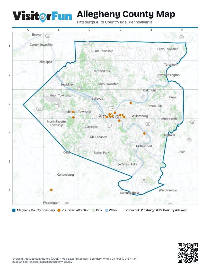
Maps inside Allegheny County
1 map inside, from the street map of Allegheny County down.
Street index of Allegheny County
Each street on the sheet and the grid squares it crosses.
- Pennsylvania TurnpikeC1, D1, D2, E2, E3, F3, F4
- Allegheny Valley ExpresswayF1, E2, F2, D3, E3
- Airport ExpresswayB2, A3, B3
- Beaver Valley ExpresswayB2, B3
- Parkway NorthC2, C3, D3
- Southern BeltwayA3, B3, B4, B5, C5
- Airport ParkwayB3
- Penn-Lincoln Parkway WestB3, D3, C4
- Steubenville PikeB3
- Ohio River BoulevardC3, D3
- Raymond P Shafer HighwayC3, C4, C5
- Crosstown BoulevardD3
- Fort Duquesne BridgeD3
- North Shore ExpresswayD3
- Penn-Lincoln Parkway EastD3, E3, F3, D4, E4
- Penn-Lincoln Parkway NorthD3
- Veterans BridgeD3
- Mon/Fayette ExpresswayD5
Things to do on the Allegheny County map
- Carnegie Museum of Art
- Carnegie Museum of Natural History
- Cathedral of Learning
- Drury Inn & Suites Pittsburgh Airport Settlers Ridge
- Drury Plaza Hotel Pittsburgh Downtown
- Duquesne Incline
- Hyatt Place Pittsburgh-North Shore
- Kennywood
- Phipps Conservatory and Botanical Gardens
- Pittsburgh Botanic Garden
- Pittsburgh Zoo & Aquarium
- Pittsburgh, PA
- PNC Park
- The Andy Warhol Museum
- The Mall at Robinson
- The Pittsburgh Tour Company
- The Terminal
Places on the map
- Agan Park
- Aleppo Township
- Allegheny Center
- Allegheny Country Club
- Allegheny County
- Allegheny Islands State Park
- Allegheny Ludlum
- Allegheny River Greenway
- Allegheny West
- Alpine Park
- ANG Apron
- Arlington
- Arlington Heights
- Aspinwall
- ATI Brackenridge Operations
- Avalon
- Baldwin
- Baldwin Township
- Banksville
- Barking Slopes
- Bedford Dwellings
- Beechview
- Beechwood Farms
- Beechwood Park
- Bell Acres
- Bell Acres Nature Park
- Bellevue
- Beltzhoover
- Ben Avon
- Ben Avon Heights
- Bethel Park
- Bethel Park Industrial Park
- Bettis Atomic Power Laboratory
- Bigelow Greenway
- Blackridge
- Blawnox
- Bloomfield
- Blueberry Hill Park
- Bluff
- Bon Air
Next to Allegheny County
- Aliquippa
- Ambridge
- Beaver
- Canonsburg
- Cecil
- Center Township
- Donora
- Irwin
- Lower Burrell
- Manor
- Monongahela
- Murrysville
- New Kensington
- Trafford
- Washington
- West Newton
© OpenStreetMap contributors (ODbL) · Map data: Protomaps · Boundary: Who's On First (CC-BY 4.0)