

Utah map
Salt Lake County map
About 1,216,274 people live here (Census Bureau, 2024 estimate). The sheet's index lists 6 streets; Dwight D. Eisenhower Highway, Veterans Memorial Highway and Belt Route cross the most grid squares. Things to do inside the boundary: Alta Ski Area, Bingham Canyon Mine and City Sights Tours.
Open the map (PDF, US Letter)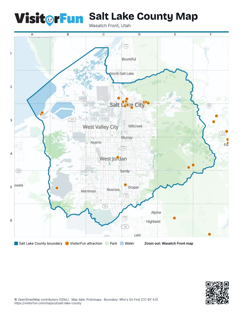
Maps inside Salt Lake County
1 map inside, from the street map of Salt Lake County down.
Street index of Salt Lake County
Each street on the sheet and the grid squares it crosses.
- Dwight D. Eisenhower HighwayB2, C2, A3, B3, C3, D3, E3, F3
- Belt RouteC2, C3, D3, C4, D4
- Legacy ParkwayC2
- Veterans Memorial HighwayC2, C3, D3, D4, D5, C6
- 2100 South FreewayB3, C3, D3
- Bangerter HighwayC3, C4, C5, D5
Things to do on the Salt Lake County map
- Alta Ski Area
- Bingham Canyon Mine
- City Sights Tours
- Clark Planetarium
- Delta Center
- Eccles Theater
- Gardner Village
- Gilgal Sculpture Garden
- Great Salt Lake State Park
- Great Saltair
- Loveland Living Planet Aquarium
- Natural History Museum of Utah
- Red Butte Garden
- Red Iguana
- Salt Lake Temple
- Snowbird Ski & Summer Resort
- Temple Square
- This Is The Place Heritage Park
- Utah Ski & Golf
- Utah State Capitol
- Utah's Hogle Zoo
Places on the map
- Alta Ski Area
- ATK Bacchus Works
- Ballpark
- Barney's Canyon Mine
- Bell Canyon Acres
- Big Cottonwood Regional Park
- Bingham Canyon Mine
- Bingham Creek Regional Park
- BLM - Salt Lake Field Office
- Bluffdale
- Bonanza Acres
- Bonneville Golf Course
- Brighton
- Brighton Resort
- BSA Camp Tracy
- Canyonview Park
- Capitol Hill
- Cascade Village
- Central City
- Central Ninth
- Copper Creek Estates
- Copper Hills Estates
- Copperton
- Corner Canyon Regional Park
- Cottonwood Heights
- Country Crossing
- Creekside Village
- Deer Mountain
- Deer Ridge Off-Leash Area
- Dimple Dell Park
- Dorilee Acres
- Downtown
- Draper
- East Bench
- East Central
- East Liberty Park
- Eastlake Village
- Emigration Canyon
- Emigration Oaks and Quad
- Fairpark
Next to Salt Lake County
- Alpine
- Bountiful
- Highland
- Lehi
- North Salt Lake
- Saratoga Springs
- Tooele
- Woods Cross
© OpenStreetMap contributors (ODbL) · Map data: Protomaps · Boundary: Who's On First (CC-BY 4.0)