

Connecticut map
New London County map
Things to do inside the boundary: Argia, Denison Pequotsepos Nature Center and Florence Griswold Museum. Also on it: Acorn Acres Campground, Airline State Park Trail (Southern Section) and Ames Family Open Space. 22 smaller maps sit inside it, among them Stonington.
Open the map (PDF, US Letter)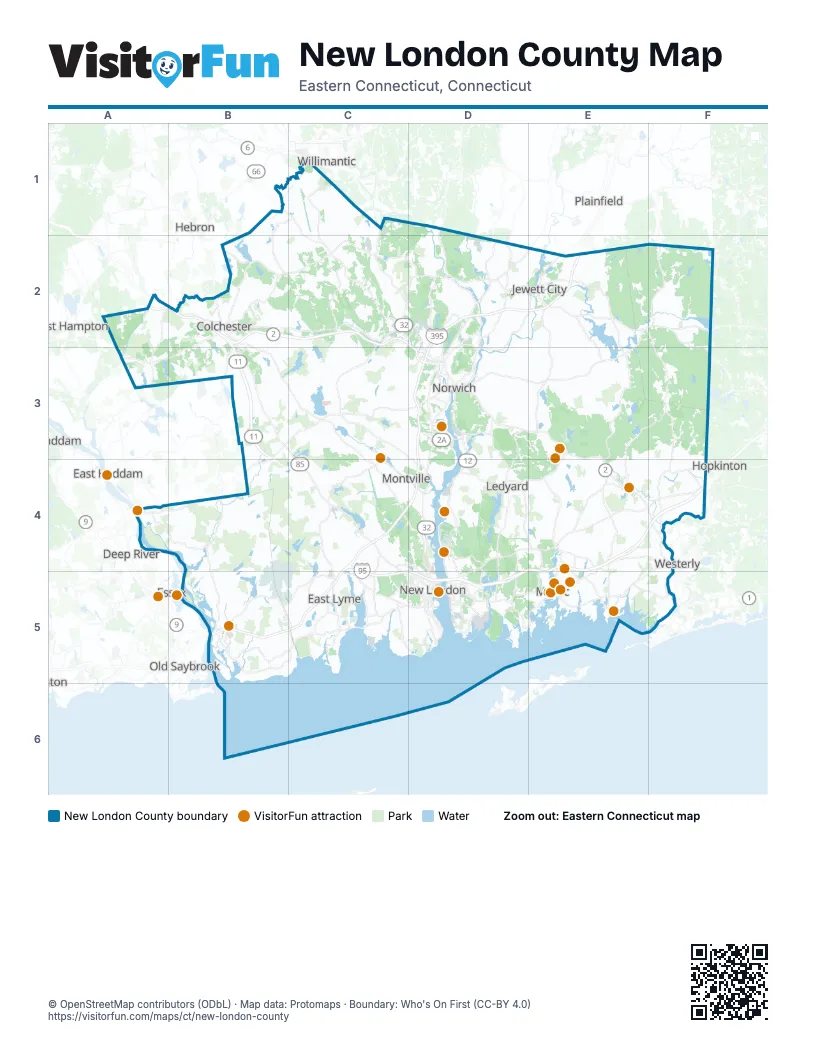
Maps inside New London County
1 map inside, from the street map of New London County down.
Things to do on the New London County map
- Argia
- Florence Griswold Museum
- Foxwoods Resort Casino
- Gillette Castle State Park
- Mashantucket Pequot Museum and Research Center
- Mohegan Sun
- Mystic Aquarium
- Mystic Country
- Mystic Knotwork
- Mystic Seaport Museum
- Nature's Art Village
- Scooter A Long
- Submarine Force Museum
- Thames River Heritage Park
- The Velvet Mill
- TreeTrails Adventures Mystic
Places on the map
- Acorn Acres Campground
- Airline State Park Trail (Southern Section)
- Ames Family Open Space
- Amos Avery Preserve
- Amos Lake
- AmSty
- Appleton Nature Preserve Tract
- Arbor Crossing
- Ashaway Sportsmans Club
- Ashland Pond
- Aspinook Pond
- Assekonk Pond
- Assekonk Swamp
- Atkinson Family Preserve
- Avery Farm Nature Preserve
- Ayers Gap Preserve
- Babcock Pond
- Babcock Pond State Wildlife Management Area
- Baltic
- Banningwood Preserve
- Barnes Reservoir
- Bartholomew Open Space
- Bates Woods Park
- Beach Pond
- Beachdale Pond
- Beaver Brook Dam
- Becket Hill State Park Reserve
- Beebe Pond Park
- Bell Cedar Swamp
- Benedict Benson Preserve
- Billings Lake
- Black Hall Club
- Blue Lake
- Bluff Point State Park
- Bobrow Property
- Bog Meadow Reservoir
- Bogue Brook Reservoir
- Bozrah
- Bozrah Rod and Gun Club
- Brewster Pond
Next to New London County
- Deep River
- East Haddam
- East Hampton
- Essex
- Haddam
- Hebron
- Hopkinton
- Old Saybrook map
- Plainfield
- Westbrook
- Westerly
- Willimantic
© OpenStreetMap contributors (ODbL) · Map data: Protomaps · Boundary: Who's On First (CC-BY 4.0)