

Florida map
Miami-Dade County map
About 2,838,461 people live here (Census Bureau, 2024 estimate). The sheet's index lists 16 streets; Homestead Extension of Florida's Turnpike, Palmetto Expressway and Gratigny Parkway cross the most grid squares. Things to do inside the boundary: AMR Homestead-Miami Motorplex, Art Deco Historic District & Ocean Drive and Aventura Mall.
Open the map (PDF, US Letter)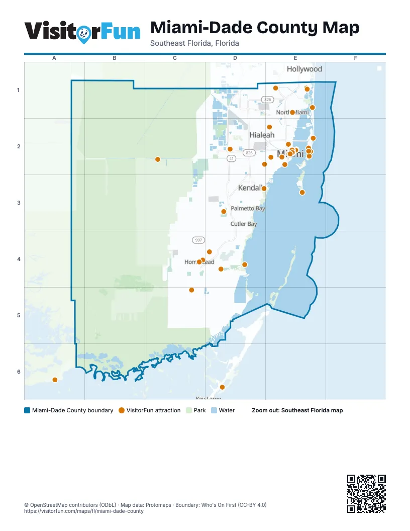
Maps inside Miami-Dade County
2 maps inside, from the street map of Miami-Dade County down.
Street index of Miami-Dade County
Each street on the sheet and the grid squares it crosses.
- Gratigny ParkwayD1, E1
- Homestead Extension of Florida's TurnpikeD1, D2, D3, C4, D4
- Palmetto ExpresswayD1, E1, D2, D3
- Florida's TurnpikeE1
- William Lehman CausewayE1
- Dolphin ExpresswayD2, E2
- Don Shula ExpresswayD2, D3
- Florida's Turnpike Thru LanesD2, D3
- Airport ExpresswayE2
- Downtown DistributorE2
- Julia Tuttle CausewayE2
- MacArthur CausewayE2
- Port Miami TunnelE2
- Florida's Turnpike Thru LaneD3
- Snapper Creek ExpresswayD3
- State Road 821 Access RoadD3
Things to do on the Miami-Dade County map
- AMR Homestead-Miami Motorplex
- Art Deco Historic District & Ocean Drive
- Aventura Mall
- Ball & Chain
- Bayside Marketplace
- Big Bus Tours Miami
- Bill Baggs Cape Florida State Park
- Biscayne National Park
- Bloomingdale's Aventura
- Coral Castle
- Coral Castle Museum
- Everglades Alligator Farm
- Everglades Safari Park
- Fairchild Tropical Botanic Garden
- Fetched Up Charters
- Fontainebleau Miami Beach
- Hard Rock Stadium
- iSkydive Miami
- Island Queen Cruises, Millionaire's Row Cruise
- Joe's Stone Crab
- Jungle Island
- Lincoln Road
- Little Havana & Calle Ocho (Domino Park)
- Luminosa at Jungle Island
- Miami
- Miami Children's Museum
- Museum of Miami
- Pérez Art Museum Miami
- Phillip and Patricia Frost Museum of Science
- Shark Valley Tram Tours
- Skyviews Miami Observation Wheel
- South Beach
- Sunny Miami Tours
- The Escape Game Miami
- Therapy IV Deep Sea Fishing
- Thriller Miami Speedboat Adventures
- Treetop Trekking Miami
- Venetian Pool
- Versailles Restaurant
- Vizcaya Museum & Gardens
- Wynwood Walls
- Zoo Miami
Places on the map
- Aventura
- Aventura Isles
- Aventura Mall
- Bal Harbour Village
- Bay Harbor Islands
- Biscayne National Park
- Biscayne Park
- Black Creek Canal
- Blue Lagoon
- Bridge Point Doral
- Brownsville
- Chapman Field Park
- Choctaw Hammock
- Collins Canal
- Coral Gables
- Coral Gables Canal
- Coral Terrace
- Corsica
- Country Club
- Country Walk
- Crandon Beach
- Crandon Park
- Crandon Park Golf Course
- Custard Apple Hammock
- Cuthbert Lake
- Cutler Bay
- Cutler Drain Canal
- Deering Estate
- Dolphin Mall
- Doral
- Dumfoundling Bay
- El Portal
- Elliott Key
- Epic Residences & Hotel
- Fisher Island
- Flagler Station
- Florida City
Next to Miami-Dade County
- Hollywood
- Key Largo
- Miramar
- Pembroke Pines
© OpenStreetMap contributors (ODbL) · Map data: Protomaps · Boundary: Who's On First (CC-BY 4.0)