

California map
San Diego County map
About 3,298,799 people live here (Census Bureau, 2024 estimate). Things to do inside the boundary: Anza-Borrego Desert State Park, Balboa Park and Bazaar Del Mundo. Also on it: Agua Tibia Wilderness, Anza-Borrego Desert State Wilderness and Black Mountain Open Space Park.
Open the map (PDF, US Letter)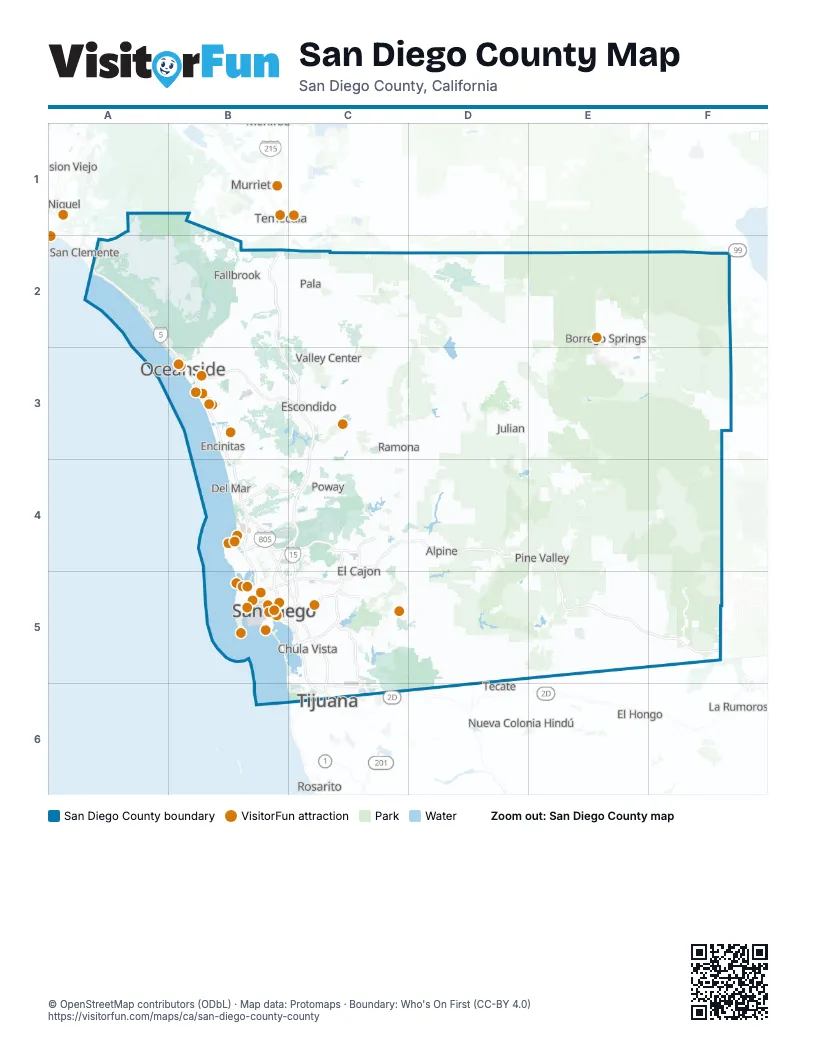
Maps inside San Diego County
2 maps inside, from the street map of San Diego County down.
Things to do on the San Diego County map
- Anza-Borrego Desert State Park
- Balboa Park
- Bazaar Del Mundo
- Belmont Park
- Big Blue Photo Boat
- Birch Aquarium at Scripps
- Broken Yolk Cafe
- Cabrillo National Monument
- California Watersports
- Carlsbad
- Casa de Bandini
- Ciné Café
- Cruise San Diego
- Fiesta de Reyes
- Gaslamp BBQ
- Highway 94 Wine Trail
- Hotel del Coronado
- La Jolla Cove
- Liberty Public Market
- Maritime Museum of San Diego
- Museum of Making Music
- Navy SEAL Museum San Diego
- Oceanside
- Oceanside Adventures
- Old Town San Diego
- Old Town San Diego State Historic Park
- Old Town Trolley Tours of San Diego
- Old Town Trolley Tours San Diego
- Petco Park Tour
- Ringer's Roller Rink
- San Diego
- San Diego Model Railroad Museum
- San Diego Natural History Museum
- San Diego Watercolor Society Gallery
- San Diego Whale Watch
- San Diego Zoo
- San Diego Zoo Safari Park
- SeaWorld San Diego
- Spanish Village Art Center
- Surf Diva
- The Old Globe Theatre
- USS Midway Museum
- Weekend Outside
- Whaley House Museum
- Wild Pacific Whale Watch
Places on the map
- Agua Tibia Wilderness
- Anza-Borrego Desert State Park
- Anza-Borrego Desert State Wilderness
- Black Mountain Open Space Park
- Borrego Valley Airport
- Carrizo Gorge Wilderness
- Cleveland National Forest
- Cottonwood Golf Club
- Cuyamaca Rancho State Park
- Daley Ranch
- Hauser Wilderness
- Los Peñasquitos Canyon Preserve
- Marine Corps Air Station Miramar
- Marine Corps Base Camp Pendleton
- MCAS Miramar Airfield
- Mission Trails Regional Park
- Naval Air Station North Island
- Naval Amphibious Base Coronado
- Naval Base Point Loma
- Naval Base San Diego
- North Island Naval Air Station
- Ocotillo Wells State Vehicular Recreation Area
- Otay Mountain Wilderness
- Palomar Mountain State Park
- Pine Creek Wilderness
- Ramona Grasslands Preserve
- San Diego International Airport
- San Diego National Wildlife Refuge
- San Diego-La Jolla Underwater Park
- San Dieguito River Park
- San Onofre State Beach
- Santa Rosa Mountains State Wilderness
- Santa Ysabel Preserve
- Sawtooth Mountains Wilderness
- Silver Strand State Beach
- Silver Strand Training Complex (North)
- South Carlsbad State Beach
- Tecolote Canyon Natural Park
Next to San Diego County
- Coachella
- El Hongo
- La Rumorosa
- Lake Elsinore
- Mission Viejo
- Murrieta
- Nueva Colonia Hindú
- Rancho Santa Margarita
- Rosarito
- San Clemente
- Tecate
- Temecula
- Tijuana
- Wildomar
© OpenStreetMap contributors (ODbL) · Map data: Protomaps · Boundary: Who's On First (CC-BY 4.0)