

Wisconsin map
Milwaukee County map
About 924,740 people live here (Census Bureau, 2024 estimate). The sheet's index lists 10 streets; North-South Freeway, Zoo Freeway and Fond du Lac Freeway cross the most grid squares. Things to do inside the boundary: American Family Field, Discovery World and Edelweiss Cruise Lines.
Open the map (PDF, US Letter)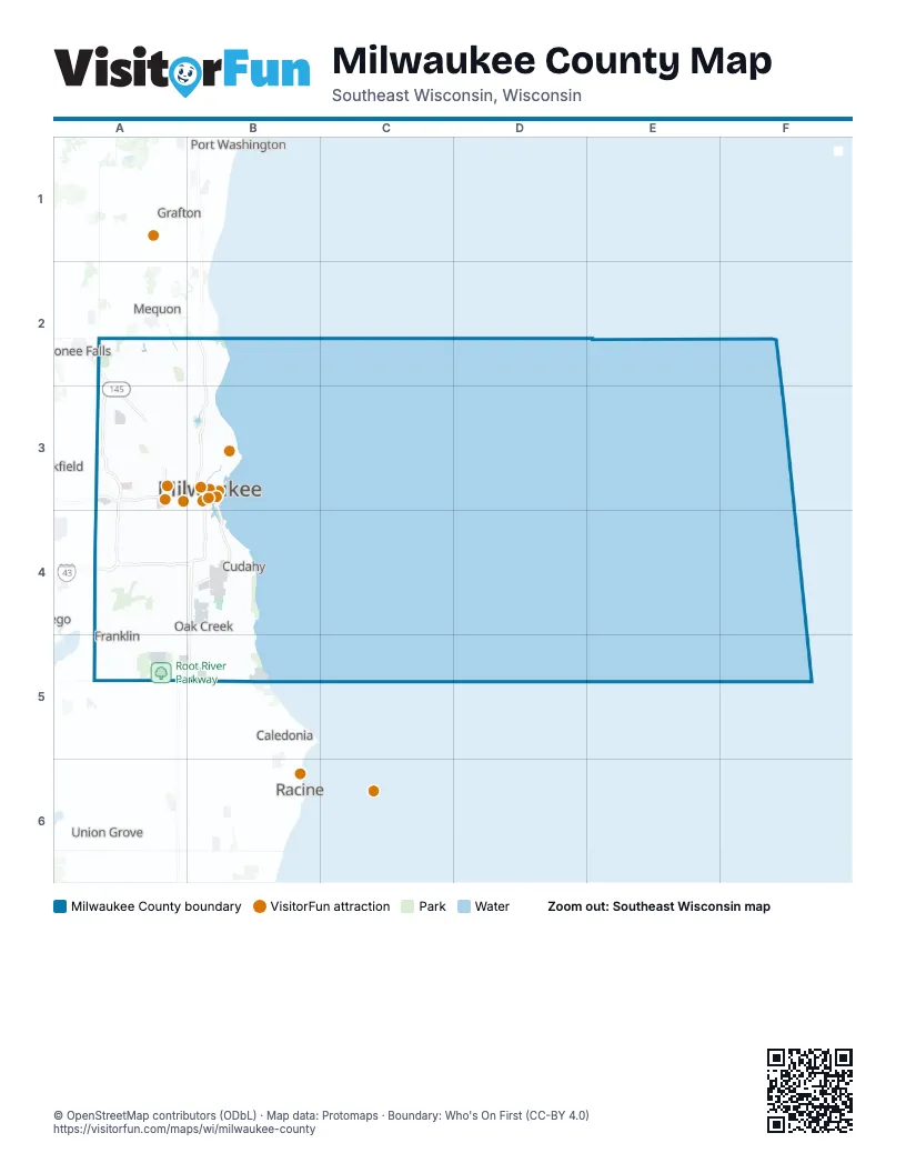
Maps inside Milwaukee County
1 map inside, from the street map of Milwaukee County down.
Street index of Milwaukee County
Each street on the sheet and the grid squares it crosses.
- Fond du Lac FreewayA2, A3
- Zoo FreewayA2, A3, A4
- North-South FreewayB2, B3, B4, A5, B5
- Brewers BoulevardA3
- East-West FreewayA3, B3
- Lake FreewayB3, B4
- Airport FreewayA4
- Rock FreewayA4
- Airport SpurB4
- John R. Plewa Memorial Lake ParkwayB4
Things to do on the Milwaukee County map
Places on the map
- 30th Street Corridor
- Alcott Park
- Alter Metal Recycling
- Alverno
- Amani
- Arlington Court
- Arlington Gardens
- Arlington Heights
- Avenues West
- Baran Park
- Bay View
- Bay View Park
- Bayside
- Beerline B
- Beerline Trail
- Bender Park
- Biwer's Woods
- Blakewood
- Blue Mound Golf & Country Club
- Bluemound Heights
- Bluemound Manor
- Borchert Field
- Bradford Beach
- Bradley Estates
- Brewers Hill
- Brewery Silo
- Brosen Manor
- Brown Deer
- Brown Deer Park
- Brown Deer Park Golf Course
- Burnham Park
- Calumet Farms
- Cambridge Woods
- Cannon Park
- Capitol Heights
- Castle Manor
- Cathedral Church of All Saints
- Center Street Marketplace
- Century City Business Park
Next to Milwaukee County
- Caledonia
- Cedarburg
- Grafton
- Menomonee Falls
- Mequon
- Mount Pleasant
- Port Washington
- Racine
- Union Grove
© OpenStreetMap contributors (ODbL) · Map data: Protomaps · Boundary: Who's On First (CC-BY 4.0)