

Connecticut map
Hartford-West Hartford-East Hartford Metro Area map
The sheet's index lists 22 highways; I-84, CT 9 and I-91 cross the most grid squares. Things to do inside the boundary: Babb's Beach, Ballard Institute and Museum of Puppetry and Bolton Notch State Park. Also on it: Avon, Berlin and Clinton.
Open the map (PDF, US Letter)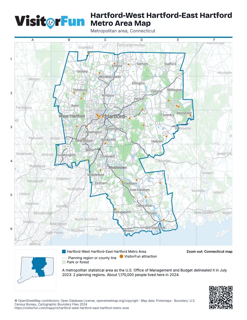
Highway index of Hartford-West Hartford-East Hartford Metro Area
Each highway on the sheet and the grid squares it crosses.
- I-84B3, B4, C2, C3, D2, E1, E2
- I-91C1, C2, C3, C4
- I-95C6, D6, E6
- I-291C2, C3
- I-384C3, D3
- I-691B4
- US 1D6, E6
- US 5B4, C2, C3, C4
- US 6B3, C3, D3, E3
- US 44B2, B3, C3, D3
- US 202B1, B2
- CT 2C3, D3, D4
- CT 3C3
- CT 9B3, B4, C3, C4, C5, D5, D6
- CT 10B1, B2, B3, B4
- CT 15B4, C3, C4
- CT 17C3, C4
- CT 20C2
- CT 66C4, D3, D4, E3
- CT 72B3
- CT 189B1
- CT 287C3
Things to do on the Hartford-West Hartford-East Hartford Metro Area map
- Babb's Beach
- Ballard Institute and Museum of Puppetry
- Bolton Notch State Park
- Chatfield Hollow State Park
- Connecticut Museum of Culture and History
- Connecticut River Museum
- Connecticut Science Center
- Connecticut Trolley Museum
- Devil's Hopyard State Park
- Dinosaur State Park
- Essex Steam Train & Riverboat
- Florence Griswold Museum
- Gay City State Park
- Gillette Castle State Park
- Goodspeed Opera House
- Higganum Reservoir State Park
- Hill-Stead Museum
- Lamentation Mountain State Park
- Lutz Children's Museum
- Machimoodus State Park
- Mansfield Hollow State Park
- Mono Pond State Park Reserve
- New Britain Museum of American Art
- New England Air Museum
- Penwood State Park
- Public Art CT
- Scantic River State Park
- Stratton Brook State Park
- Talcott Mountain State Park
- The Adventure Park at Storrs
- The Mark Twain House & Museum
- Wadsworth Atheneum Museum of Art
- Wadsworth Falls State Park
- Webb-Deane-Stevens Museum
- Westfarms
- William Benton Museum of Art
- Windsor Locks Canal State Park Trail
Places on the map
- Avon
- Berlin
- Clinton
- Coventry
- Cromwell
- Deep River
- Durham
- East Haddam
- Ellington
- Enfield
- Essex
- Glastonbury
- Granby
- Haddam
- Hartford
- Hebron
- Killingworth
- Mansfield
- Middlefield
- Middletown
- New Britain
- Newington
- Old Saybrook
- Rocky Hill
- Simsbury
- Somers
- Southington
- Stafford
- Tolland
- Vernon
- West Hartford
- Willington
- Windsor
- Windsor Locks
© OpenStreetMap contributors, Open Database License, openstreetmap.org/copyright · Map data: Protomaps · Boundary: U.S. Census Bureau, Cartographic Boundary Files 2024















