

Massachusetts map
Plymouth County map
About 542,090 people live here (Census Bureau, 2024 estimate). The sheet's index lists 3 streets; Pilgrim Highway, Pilgrims Highway and Amvets Highway cross the most grid squares. Things to do inside the boundary: Buzzards Bay Yacht Charters, Captain John Boats and Onset.
Open the map (PDF, US Letter)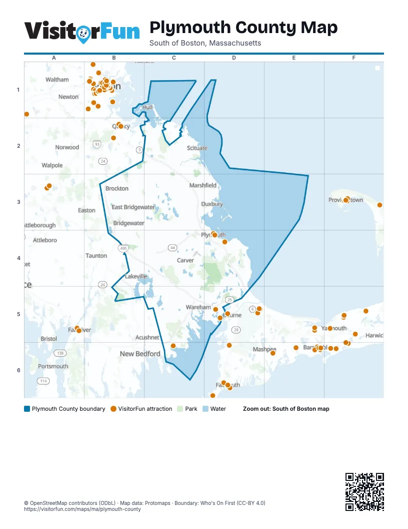
Street index of Plymouth County
Each street on the sheet and the grid squares it crosses.
- Pilgrim HighwayB2, C2, C3, C4, D4, D5
- Pilgrims HighwayC2, C3, D4, D5
- Amvets HighwayB3, B4
Things to do on the Plymouth County map
Places on the map
- "The Spit" Tidal Sandbar
- #2 Well
- Abington
- Accord Pond
- Ames Nowell State Park
- Aquifer Prot. Land - Dep/Ala
- Ashdod Forest
- Assawompset Pond
- Assonet Cedar Swamp Wildlife Sanctuary
- Atlantic Country Club
- Atwood Upper Reservoir
- Aucoot / Bowman Preserve
- Aucoot Woods
- Bare Cove Park
- Barnabas Land
- Bassing Beach
- Bates Lane Conservation Area
- Bay Club at Mattapoisett
- Bay Pointe
- Bear Meadow
- Beaver Brook Beagle Club
- Beaver Brook Conservation Land
- Besse Bog Reservoir
- Big Sandy Pond
- Billington Sea
- Black Brook
- Black Cat Preserve
- Black Pond Bog Preserve
- Black Pond Swamp
- Black Rock Country Club
- Bloody Pond
- Bluefish River
- Bluefish River Marshes
- Boot Pond
- Booth Hill Conservation Area
- Boston Golf Club
- Boston/Cape Cod KOA
- Bridgewater
- Bridgewater State Forest
- Briggs Property
Next to Plymouth County
- Acushnet
- Attleboro
- Barnstable
- Boston map
- Bourne
- Bristol
- Cambridge
- Canton
- Dartmouth
- Easton
- Fall River
- Falmouth
- Harwich
- Mashpee
- Medfield
- Natick
- New Bedford
- Newton
- North Attleborough
- Norton
- Norwood
- Portsmouth
- Provincetown map
- Quincy
- Sandwich
- Seekonk
- Taunton
- Tiverton
- Walpole
- Waltham
- Weymouth
- Yarmouth
© OpenStreetMap contributors (ODbL) · Map data: Protomaps · Boundary: Who's On First (CC-BY 4.0)