

Minnesota map
Hennepin County map
About 1,273,334 people live here (Census Bureau, 2024 estimate). The sheet's index lists 17 streets; MN-610, Crosstown Highway and I-94 E cross the most grid squares. Things to do inside the boundary: American Swedish Institute, First Avenue and General Store of Minnetonka.
Open the map (PDF, US Letter)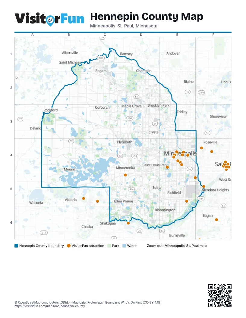
Maps inside Hennepin County
1 map inside, from the street map of Hennepin County down.
Street index of Hennepin County
Each street on the sheet and the grid squares it crosses.
- Main StreetC1
- MN 101 North BypassC1
- County Road 610C2
- I-94 EC2, D3
- I-94 WC2
- MN-610C2, D2, E2
- Officer Bill Mathews Memorial HighwaC4
- Minnesota State Highway 7D4
- Hiawatha AvenueE4
- South 7th StreetE4
- South 8th StreetE4
- Crosstown HighwayD5, E5, F5
- Normandale BoulevardD5
- Cedar Avenue SouthE5, E6
- Fort RoadF5
- John A. Johnson Memorial HighwayF5
- Cedar AvenueE6
Things to do on the Hennepin County map
- American Swedish Institute
- First Avenue
- General Store of Minnetonka
- Guthrie Theater
- Historic Fort Snelling
- Mall of America
- Midtown Global Market
- Mill City Museum
- Minneapolis Chain of Lakes Regional Park
- Minneapolis Institute of Art
- Minnehaha Regional Park
- Spoonbridge and Cherry
- Stone Arch Bridge
- Target Field
- The Basilica of Saint Mary
- U.S. Bank Stadium
- Walker Art Center & Minneapolis Sculpture Garden
- Weisman Art Museum
Places on the map
- Above the Falls Regional Park
- Amhurst
- Aquila
- Arbor Lakes Retail Center
- Armatage
- Audobon Park
- Autumn Woods
- Baker Park Reserve
- Bancroft
- Bass Creek Business Park
- Bass Lake
- Bassett Creek
- Bassett Creek Lagoons
- Bde Maka Ska
- Bde Maka Ska-Isles
- Bearpath
- Beltrami
- Bent Creek Golf Club
- Big Island Nature Park
- Big Willow Park
- Bill Warren Park
- Birch Island Park
- Birchwood
- Blackstone
- Bloomington
- Bottineau
- Boundary Creek Park
- Braemar Golf Course
- Brayburn Trails
- Bredesen Park
- Bronx Park
- Brookdale Park
- Brooklawns
- Brooklyn Center
- Brooklyn Park
- Brookside
- Brookview Golf Course
- Brookview Heights
- Browndale
- Bryant
Next to Hennepin County
- Albertville
- Andover
- Arden Hills
- Blaine
- Burnsville
- Chanhassen
- Chaska
- Coon Rapids
- Delano
- Eagan
- Fridley
- Ham Lake
- Lino Lakes
- Mendota Heights
- Mounds View
- New Brighton
- Ramsey
- Rockford
- Roseville
- Saint Michael
- Saint Paul
- Savage
- Shakopee
- Shoreview
- Victoria
- Waconia
© OpenStreetMap contributors (ODbL) · Map data: Protomaps · Boundary: Who's On First (CC-BY 4.0)