

California map
Los Angeles County map
About 9,757,179 people live here (Census Bureau, 2024 estimate). Things to do inside the boundary: Academy Museum of Motion Pictures, Amoeba Music Hollywood and Angels Flight Railway. Also on it: Angeles National Forest, Malibu Creek State Park and Naval Reservation San Clemente Island.
Open the map (PDF, US Letter)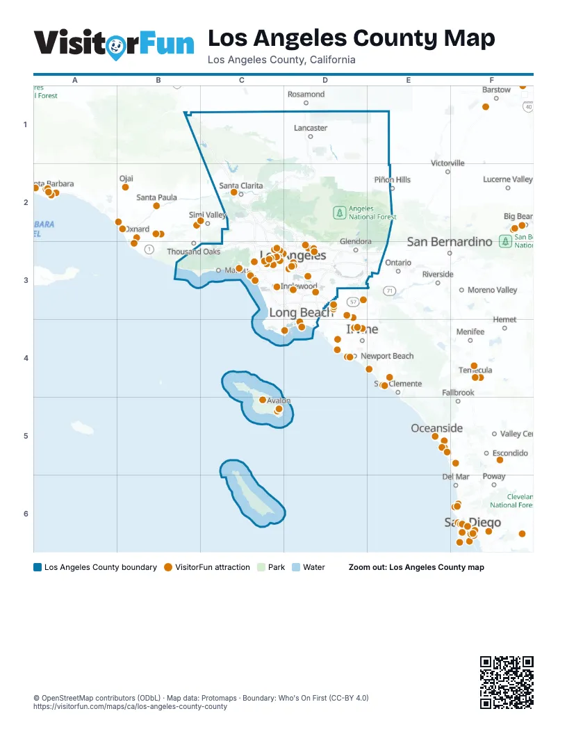
Maps inside Los Angeles County
3 maps inside, from the street map of Los Angeles County down.
Things to do on the Los Angeles County map
- Academy Museum of Motion Pictures
- Amoeba Music Hollywood
- Angels Flight Railway
- Aqua Surf School
- Aquarium of the Pacific
- Bembridge House
- California Parasail Catalina Island
- Catalina Adventure Tours
- Catalina Express
- Catalina Island
- Catalina Island Horseback Adventures
- Catalina Museum for Art & History
- Catalina Sea Spa
- Catalina Tour Guide
- Chateau Marmont
- Citadel Outlets
- Crypto.com Arena
- Dodger Stadium
- Dolby Theatre
- Eric's on the Pier
- Getty Villa
- Glenmore Plaza Hotel
- Golf N' Stuff
- Grand Central Market
- Greek Theatre
- Griffith Observatory
- Haunted Catalina Ghost Tour
- Hollywood Bowl
- Hollywood Bus Tours
- Hollywood Pantages Theatre
- Hollywood Sign
- Hollywood Walk of Fame
- Hotel Metropole
- Immersed Catalina
- Island Water Charters Parasailing
- La Brea Tar Pits
- Los Angeles
- Los Angeles County Museum of Art (LACMA)
- Maverick Helicopters Long Beach
- Melrose Trading Post
- Old Pasadena
- Olvera Street
- Original Farmers Market & The Grove
- Pacific Park
- Paramount Studio Tour
- Pasadena
- Petersen Automotive Museum
- Ripley's Believe It or Not Hollywood
- Rodeo Drive
- Rose Bowl Stadium
- Santa Monica
- Santa Monica Pier
- SoFi Stadium
- Sunset Strip
- TCL Chinese Theatre
- The Beverly Hills Hotel
- The Broad
- The Comedy Store
- The Getty Center
- The Huntington Library, Art Museum, and Botanical Gardens
- The Queen Mary
- Universal Studios Hollywood
- Venice Beach Boardwalk
- Walt Disney Concert Hall
- Warner Bros. Studio Tour Hollywood
- Watts Towers
- Whisky a Go Go
Places on the map
- Angeles National Forest
- Malibu Creek State Park
- Naval Reservation San Clemente Island
- Pleasant View Ridge Wilderness
- San Gabriel Mountains National Monument
- San Gabriel Wilderness
- Santa Monica Mountains National Recreation Area
- Sheep Mountain Wilderness
- Topanga State Park
- Zuma and Trancas Canyons
Next to Los Angeles County
- Adelanto
- Anaheim map
- Apple Valley
- Banning
- Barstow
- Big Bear City
- Carpinteria
- Del Mar
- El Cajon
- Escondido
- Fallbrook
- Fontana map
- Hemet
- Highland
- Irvine map
- Jurupa Valley
- Lake Elsinore
- Lucerne Valley
- Menifee
- Mission Viejo
- Moreno Valley map
- Newport Beach
- Oceanside
- Ojai
- Ontario
- Oxnard
- Perris
- Piñon Hills
- Poway
- Ramona
- Rancho Cucamonga
- Riverside map
- Rosamond
- San Bernardino map
- San Clemente
- San Diego map
- Santa Barbara
- Santa Paula
- Simi Valley
- Spring Valley
- Temecula
- Temescal Valley
- Thousand Oaks
- Valley Center
- Victorville
- Wildomar
© OpenStreetMap contributors (ODbL) · Map data: Protomaps · Boundary: Who's On First (CC-BY 4.0)