

District of Columbia road map
I-395 in District of Columbia map
I-395 is about 3 miles in District of Columbia. It has 9 exits, from Exit 10C at mile 0 to Exit 10 at mile 2. It meets US 1 and US 50.
Open the map (PDF, US Letter)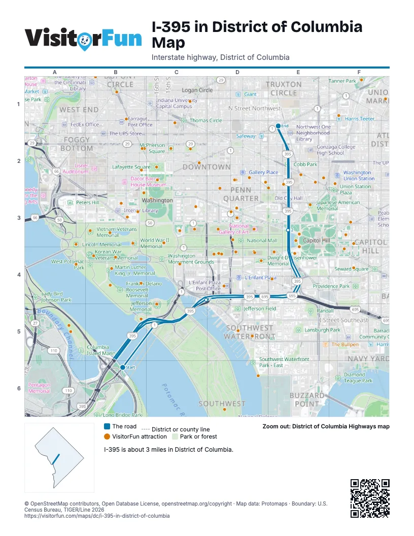
Exits on I-395 in District of Columbia
Each exit in mile order, with its grid square.
- Exit 10Cmile 0, B5
- Exit 1mile 0, B5
- Exit 2mile 1, D5
- Exit 3mile 1, D5
- Exit 4mile 1, D5
- Exit 4B-Amile 1, D5
- Exit 8mile 2, E3
- Exit 9mile 2, E3
- Exit 10mile 2, E3
Highways I-395 meets
Each highway it meets and the grid squares where they meet.
- US 1B5
- US 50E1
Towns along I-395 in District of Columbia
In mile order, with the grid square of each.
- Washingtonmile 0, B5
Things to do on the I-395 in District of Columbia map
- Lady Bird Johnson Park
- Lyndon Baines Johnson Memorial Grove on the Potomac
- John Ericsson National Memorial
- Franklin Delano Roosevelt Memorial
- Korean War Veterans Memorial
- George Mason Memorial
- Martin Luther King, Jr. Memorial
- District of Columbia War Memorial
- Tidal Basin
- East Potomac Park
- Thomas Jefferson Memorial
- World War II Memorial
- Women's Titanic Memorial
- United States Holocaust Memorial Museum
- Washington Monument
- Arena Stage
- International Spy Museum
- National Museum of African American History and Culture
- Enid A. Haupt Garden
- National Museum of African Art
- National Museum of Asian Art
- Smithsonian National Museum of American History
- Hirshhorn Museum and Sculpture Garden
- Museum of the Bible
- National Mall
- Smithsonian National Museum of Natural History
- Dwight D. Eisenhower Memorial
- Smithsonian National Air and Space Museum
- National Museum of the American Indian
- United States Botanic Garden
- James A. Garfield Monument
- Library of Congress, Thomas Jefferson Building
- Folger Shakespeare Library
- U.S. Capitol & Capitol Visitor Center
- Ulysses S. Grant Memorial
- National Gallery of Art
- Peace Monument
- Supreme Court of the United States
- National Archives Museum
- Belmont–Paul Women's Equality National Monument
- Pennsylvania Avenue National Historic Site
- National Children's Museum
- United States Navy Memorial
- Japanese American Memorial to Patriotism During World War II
- Ford's Theatre
- National Law Enforcement Officers Memorial
- Capital One Arena
- Holodomor Memorial
- Lillian & Albert Small Capital Jewish Museum
- National Building Museum
- National Portrait Gallery
- Old Town Trolley Tours of Washington DC
- Smithsonian American Art Museum
- Union Station
- National Postal Museum
- Victims of Communism Memorial
- National Museum of Women in the Arts
- Franklin Square
- McPherson Square
- African American Civil War Memorial
- Mary McLeod Bethune Council House National Historic Site
© OpenStreetMap contributors, Open Database License, openstreetmap.org/copyright · Map data: Protomaps · Boundary: U.S. Census Bureau, TIGER/Line 2026















